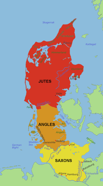
File:Angles saxons jutes.png
Appearance

Size of this preview: 332 × 600 pixels. Other resolutions: 133 × 240 pixels | 266 × 480 pixels | 964 × 1,741 pixels.
Original file (964 × 1,741 pixels, file size: 111 KB, MIME type: image/png)
File history
Click on a date/time to view the file as it appeared at that time.
| Date/Time | Thumbnail | Dimensions | User | Comment | |
|---|---|---|---|---|---|
| current | 12:15, 25 December 2008 |  | 964 × 1,741 (111 KB) | TharkunColl | A new version of the previous map. |
| 21:25, 24 April 2008 |  | 964 × 1,741 (113 KB) | TharkunColl | A new version of the previous map. | |
| 23:34, 28 December 2007 |  | 964 × 1,741 (112 KB) | TharkunColl | {{Information |Description=Location of the Angles, Saxons and jutes before their migrations to Britain |Source=self-made |Date=28 December 2007 |Location= |Author=TharkunColl |Permission= |other_versions=Based on Image:Jutland Peninsula map.PNG }} |
File usage
The following page uses this file:
Global file usage
The following other wikis use this file:
- Usage on ar.wikipedia.org
- Usage on cy.wikipedia.org
- Usage on de.wikipedia.org
- Usage on frr.wikipedia.org
- Usage on sl.wikipedia.org

