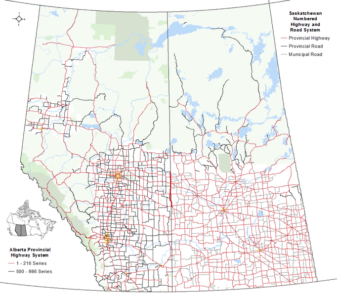
File:Alberta Highway 017.png
Appearance

Size of this preview: 682 × 599 pixels. Other resolutions: 273 × 240 pixels | 546 × 480 pixels | 874 × 768 pixels | 1,114 × 979 pixels.
Original file (1,114 × 979 pixels, file size: 107 KB, MIME type: image/png)
File history
Click on a date/time to view the file as it appeared at that time.
| Date/Time | Thumbnail | Dimensions | User | Comment | |
|---|---|---|---|---|---|
| current | 20:51, 12 November 2016 |  | 1,114 × 979 (107 KB) | Hwy43 | Add Grasslands National Park and SK's numbered municipal roads (legend title for SK changed to be inclusive of numbered municipal roads). |
| 06:27, 11 November 2016 |  | 1,114 × 979 (100 KB) | Hwy43 | Expand map to include Saskatchewan since the highway is biprovincial, shared between both Alberta and Saskatchewan, forming the boundary between the two provinces in some locations | |
| 04:00, 28 October 2016 |  | 557 × 941 (64 KB) | Hwy43 | User created page with UploadWizard |
File usage
The following 2 pages use this file:
Global file usage
The following other wikis use this file:
- Usage on www.wikidata.org
