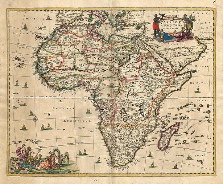
File:Afrika Map 1689.JPG
Appearance

Size of this preview: 723 × 599 pixels. Other resolutions: 290 × 240 pixels | 579 × 480 pixels | 926 × 768 pixels | 1,235 × 1,024 pixels | 2,470 × 2,048 pixels | 4,522 × 3,749 pixels.
Original file (4,522 × 3,749 pixels, file size: 15.97 MB, MIME type: image/jpeg)
File history
Click on a date/time to view the file as it appeared at that time.
| Date/Time | Thumbnail | Dimensions | User | Comment | |
|---|---|---|---|---|---|
| current | 02:51, 30 November 2006 |  | 4,522 × 3,749 (15.97 MB) | Tarawneh | == Summary == {{Information |Description= ِAfrika map - Produced in Amsterdam<br> FIRST edition : 1689 <br> Produced using copper engraving |Source= scanned copy |Date= This edition 1689 |Author= van Schagen |Permission= Public Domain |other_versions= |
File usage
The following 2 pages use this file:
Global file usage
The following other wikis use this file:
- Usage on azb.wikipedia.org
- Usage on eu.wikipedia.org
- Usage on fa.wikipedia.org
- Usage on fr.wikipedia.org
- Usage on hr.wikipedia.org
- Usage on mwl.wikipedia.org
- Usage on pl.wikipedia.org
- Usage on ru.wikipedia.org
- Обсуждение участника:Камарад Че
- Обсуждение участника:Fieke Schwarz
- Проект:Тематическая неделя африканских регионов/Неделя африканской литературы
- Участник:Fieke Schwarz
- Обсуждение участника:Джош Шихан
- Участник:Fantomaizer
- Обсуждение участника:Fantomaizer
- Обсуждение участника:GAZ1979
- Обсуждение участника:GAZ1979/Архив
- Обсуждение участника:ШаманСемен/Архив/Jul2020-Jun2022
- Usage on sh.wikipedia.org
- Usage on tn.wikipedia.org
