File:49955 1665rslcontextmap.jpg
Appearance

Size of this preview: 800 × 378 pixels. Other resolutions: 320 × 151 pixels | 640 × 302 pixels | 1,024 × 484 pixels | 1,905 × 900 pixels.
Original file (1,905 × 900 pixels, file size: 667 KB, MIME type: image/jpeg)
File history
Click on a date/time to view the file as it appeared at that time.
| Date/Time | Thumbnail | Dimensions | User | Comment | |
|---|---|---|---|---|---|
| current | 19:55, 21 March 2019 |  | 1,905 × 900 (667 KB) | Tuvalkin | Cropped 1 % horizontally, 17 % vertically using CropTool with precise mode. |
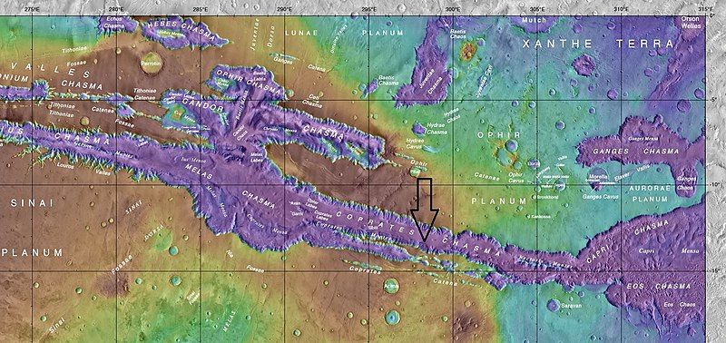
| 17:36, 6 June 2017 |  | 1,920 × 1,080 (742 KB) | Jimmarsmars | {{Information |Description ={{en|1=Topo map showing names of features near Vallis Marineris with an arrow pointing toward seasonal flows seen with hirise image ESP_049955_1665}} |Source =https://planetarynames.wr.usgs.gov/images/mc18_2014.pd... |
File usage
The following 3 pages use this file:
Global file usage
The following other wikis use this file:
- Usage on ar.wikipedia.org
- Usage on fr.wikipedia.org
- Usage on zh.wikipedia.org


