Jump to content

File:22S 1980 track.png

Page contents not supported in other languages.
This is a file from the Wikimedia Commons
From Wikipedia, the free encyclopedia

Original file (2,700 × 1,669 pixels, file size: 734 KB, MIME type: image/png)

Description
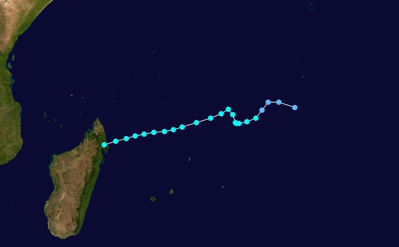
English: Track map of Cyclone 22S of the 1979-80 South-West Indian Ocean cyclone season. The points show the location of the storm at 6-hour intervals. The color represents the storm's maximum sustained wind speeds as classified in the Saffir-Simpson Hurricane Scale (see below), and the shape of the data points represent the nature of the storm, according to the legend below.
 
Tropical depression (≤38 mph, ≤62 km/h)
 
Tropical storm (39–73 mph, 63–118 km/h)
 
Category 1 (74–95 mph, 119–153 km/h)
 
Category 2 (96–110 mph, 154–177 km/h)
 
Category 3 (111–129 mph, 178–208 km/h)
 
Category 4 (130–156 mph, 209–251 km/h)
 
Category 5 (≥157 mph, ≥252 km/h)
 
Unknown

Storm type

▲ Extratropical cyclone / Remnant low / Tropical disturbance / Monsoon depression
Date
Source The background image is from NASA. Tracking data is from JTWC
Author Supportstorm
Public domain I, the copyright holder of this work, release this work into the public domain. This applies worldwide.
In some countries this may not be legally possible; if so:
I grant anyone the right to use this work for any purpose, without any conditions, unless such conditions are required by law.

Captions

Add a one-line explanation of what this file represents

Items portrayed in this file

depicts

30 June 2013

image/png

b5525a3ecf1ad7fa4e0ca34fff9ad8faefe48a04

751,451 byte

1,669 pixel

2,700 pixel

File history

Click on a date/time to view the file as it appeared at that time.

Date/TimeThumbnailDimensionsUserComment
current13:51, 30 June 2013Thumbnail for version as of 13:51, 30 June 20132,700 × 1,669 (734 KB)Supportstorm{{Information |Description={{en|Track map of Cyclone 22S of the 1979-80 South-West Indian Ocean cyclone season. The points show the lo...

The following page uses this file: