Jump to content

File:20181002082959-db85859e.jpg

Page contents not supported in other languages.
This is a file from the Wikimedia Commons
From Wikipedia, the free encyclopedia

Original file (1,536 × 1,024 pixels, file size: 1.13 MB, MIME type: image/jpeg)

Description
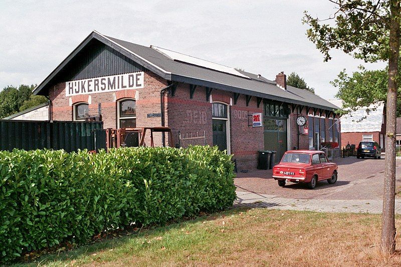
Nederlands: NTM station Hijkersmilde lag aan de op 1 juli 1915 geopende stoomtramlijn Oosterwolde - Assen en aan de op 1 juli 1916 geopende lijn van dit station naar Meppel. Die laatste lijn sloot al op 16 februari 1933 en op 5 oktober 1947 werd de lijn van Hijkersmilde naar Assen opgeheven en betekende ook de lsuiting van dit station. Het goederenvervoer naar Hijkersmilde vanaf Steenwijk via Hoek Makkinga naar één of meer bedrijven in Hijkersmilde liep door tot 30 september 1962, maar dat bereikte dit station niet meer.

Voor het station staat de Daf 46

Camera: Canon Eos 3000 Film: Fujifilm Superia 200 ISO

LEAD Technologies Inc. V1.01$
This is an image of a provincial monument in Drenthe with number PM1-0160
Date
Source http://www.roepers.net/picture.php?/796/category/63
Author Marco Roepers
Permission
(Reusing this file)
CC Attribution 4.0 International
Camera location52° 55′ 45.89″ N, 6° 25′ 23.03″ E Kartographer map based on OpenStreetMap.View this and other nearby images on: OpenStreetMapinfo
Object location52° 55′ 46.34″ N, 6° 25′ 22.53″ E Kartographer map based on OpenStreetMap.View this and other nearby images on: OpenStreetMapinfo
w:en:Creative Commons
attribution share alike
This file is licensed under the Creative Commons Attribution-Share Alike 4.0 International license.
You are free:
  • to share – to copy, distribute and transmit the work
  • to remix – to adapt the work
Under the following conditions:
  • attribution – You must give appropriate credit, provide a link to the license, and indicate if changes were made. You may do so in any reasonable manner, but not in any way that suggests the licensor endorses you or your use.
  • share alike – If you remix, transform, or build upon the material, you must distribute your contributions under the same or compatible license as the original.

Captions

Add a one-line explanation of what this file represents

Items portrayed in this file

depicts

52°55'45.89328"N, 6°25'23.03234"E

12 August 2018

52°55'46.33561"N, 6°25'22.53000"E

image/jpeg

3c7367d3d528b1298f284f5282d0dd4e6886c0ea

1,183,546 byte

1,024 pixel

1,536 pixel

File history

Click on a date/time to view the file as it appeared at that time.

Date/TimeThumbnailDimensionsUserComment
current07:11, 2 October 2018Thumbnail for version as of 07:11, 2 October 20181,536 × 1,024 (1.13 MB)RoepersTransferred from http://www.roepers.net/upload/2018/10/02/20181002082959-db85859e.jpg

The following page uses this file:

Global file usage

The following other wikis use this file:

Metadata