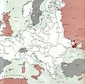
File:1943-11-01GerWW2BattlefrontAtlas.jpg
Appearance

Size of this preview: 606 × 599 pixels. Other resolutions: 243 × 240 pixels | 486 × 480 pixels | 777 × 768 pixels | 1,229 × 1,215 pixels.
Original file (1,229 × 1,215 pixels, file size: 1.17 MB, MIME type: image/jpeg)
File history
Click on a date/time to view the file as it appeared at that time.
| Date/Time | Thumbnail | Dimensions | User | Comment | |
|---|---|---|---|---|---|
| current | 16:41, 28 August 2011 |  | 1,229 × 1,215 (1.17 MB) | Cropbot | upload cropped version, operated by User:Finavon. Summary: caption cropped |
| 15:47, 24 December 2007 |  | 1,274 × 1,754 (1.68 MB) | Mike Young | {{Information |Description= thumb|left|75pxthumb|right|75pxMap of the front against Germany: This map is taken from the source "Atlas of the World Battle Fronts in Semimonthly |
File usage
The following 6 pages use this file:
Global file usage
The following other wikis use this file:
- Usage on ar.wikipedia.org
- Usage on az.wikipedia.org
- Usage on be.wikipedia.org
- Usage on bg.wikipedia.org
- Usage on da.wikipedia.org
- Usage on en.wikisource.org
- Usage on et.wikipedia.org
- Usage on fr.wikipedia.org
- Usage on id.wikipedia.org
- Usage on ko.wikipedia.org
- Usage on nl.wikipedia.org
- Usage on no.wikipedia.org
- Usage on pnb.wikipedia.org
- Usage on pt.wikipedia.org
- Usage on ru.wikipedia.org
- Usage on tr.wikipedia.org
- Usage on uk.wikipedia.org
- Usage on ur.wikipedia.org
- Usage on vi.wikipedia.org


