Farmers Market District, Dallas
Appearance
(Redirected from Farmers Market, Dallas, Texas)
Farmers Market District | |
|---|---|
 The downtown skyline from the market | |
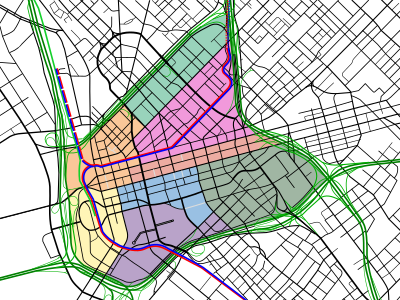
 Location in Dallas | |
| Country | United States |
| State | Texas |
| Counties | Dallas |
| City | Dallas |
| Area | Downtown |
| Elevation | 446 ft (136 m) |
| ZIP code | 75201 |
| Area code(s) | 214, 469, 972 |

The Farmers Market District is an area in southeastern downtown Dallas, Texas (USA). It lies south of the Main Street District, north of the Cedars, west of Deep Ellum, northeast of the Convention Center District, and southeast of the Government District.
Notable Structures and Parks
[edit]- Dallas Farmers Market
- Harwood Historic District
- First Presbyterian Church of Dallas

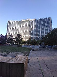
The Dallas Statler Hilton taken from the Main Street Garden Park.
Education
[edit]The district is zoned to schools in the Dallas Independent School District.
Residents of the district are zoned to City Park Elementary School, Billy Earl Dade Middle School, and James Madison High School.[1]
References
[edit]- ^ Dallas ISD - 2006 School Feeder Patterns Archived April 9, 2007, at the Wayback Machine - James Madison High School Archived February 5, 2007, at the Wayback Machine. (Maps: ES: City Park Archived June 20, 2007, at the Wayback Machine; MS: Dade Archived June 20, 2007, at the Wayback Machine; HS: Madison Archived June 20, 2007, at the Wayback Machine.) Retrieved 31 December 2006.
External links
[edit]32°46′39″N 96°47′24″W / 32.7774°N 96.7901°W


