State road D.525 (Turkey)
| D.525 | |
|---|---|
 | |
| Route information | |
| Length | 106 km (66 mi) |
| Major junctions | |
| North end | Germencik |
| South end | Milas |
| Location | |
| Country | Turkey |
| Highway system | |
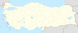
The D.525 is a north-to-south state road in southwestern Turkey, running from Germencik in Aydın Province to Milas in Muğla Province.[1]
The majority of the road is a dual carriageway and connects notable historic sites including Heraclea, Euromus, Priene, Didyma, and Miletus.
The route crosses the Büyük Menderes River, and then follows Lake Bafa before entering the Karacabel Tunnel.
It links key tourist destinations, including Kuşadası (via D.515), Didim (via 09.59), and Bodrum (via D.330). The road passes through several towns as you head southbound including Söke, Pınarcık, Bafa, before ending at a roundabout in Milas where you can join the D.330.
At the north end of the road, there is a spur which briefly follow a single carriageway road. There is a roundabout in Ortaklar where it intersects the D.550. Alternatively you can continue to Germencik where the road also intersects the D.550 before joining the O.31
Itinerary
[edit]| Province | Location | Distance from Germencik (km) | Distance from Germencik (mile) | Distance from Milas (km) | Distance from Milas (mile) |
|---|---|---|---|---|---|
| Aydın | Germencik | 0 | 0 | 106.0 | 65.9 |
| Ortaklar | 6.5 | 4.0 | 99.5 | 61.8 | |
| Argavlı | 9.1 | 5.7 | 96.9 | 60.2 | |
| Sazlı | 16.0 | 9.9 | 90.0 | 55.9 | |
| Söke | 19.9 | 12.4 | 86.1 | 53.5 | |
| Güllübahçe | 26.1 | 13.4 | 79.9 | 49.6 | |
| Sarıkemer | 43.6 | 27.1 | 62.4 | 38.8 | |
| Akköy | 50.6 | 31.4 | 55.4 | 34.4 | |
| Didim | 53.5 | 33.2 | 52.5 | 32.6 | |
| Muğla | Pınarcık | 70.8 | 44.0 | 35.2 | 21.9 |
| Bafa | 74.1 | 46.0 | 31.9 | 19.8 | |
| Ekindere | 82.3 | 51.1 | 23.7 | 14.7 | |
| Milas | 106.0 | 65.9 | 0 | 0 |


