Draft:Acre Geoglyphs
 | Review waiting, please be patient.
This may take 8 weeks or more, since drafts are reviewed in no specific order. There are 1,725 pending submissions waiting for review.
Where to get help
How to improve a draft
You can also browse Wikipedia:Featured articles and Wikipedia:Good articles to find examples of Wikipedia's best writing on topics similar to your proposed article. Improving your odds of a speedy review To improve your odds of a faster review, tag your draft with relevant WikiProject tags using the button below. This will let reviewers know a new draft has been submitted in their area of interest. For instance, if you wrote about a female astronomer, you would want to add the Biography, Astronomy, and Women scientists tags. Editor resources
Reviewer tools
|
 Acre Geoglyph in Fazenda Colorada | |
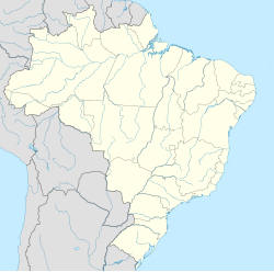
| Location | Acre, |
|---|---|
| Region | Western Amazon |
| Coordinates | 09°02′52″S 70°31′35″W / 9.04778°S 70.52639°W |
| Type | Geoglyph |
| History | |
| Cultures | Pre-colonial Amazonian societies |
| Site notes | |
| Discovered | 1977 |
| Archaeologists | Ondemar Dias |
The Acre Geoglyphs are a group of ancient geoglyphs located in the Brazilian state of Acre. Called “earth tattoos” by some Indigenous groups in the region,[1][2] these excavated earth structures were documented in the 1970s, more precisely 1977,[3][4] when researcher Ondemar Dias noted eight of them in the land of Acre while carrying out his activities for the National Program for Archaeological Research in the Amazon Basin (Pronapaba). In 2018, one of these geoglyphs in Acre, which is approximately 2,500 years old, was listed by the National Institute of Historic and Artistic Heritage (IPHAN). The set of geoglyphs in Acre is currently on the World Heritage Tentative List as a candidate for Brazil.[5]
Localization
[edit]Geoglyphs have been found in the southwestern region of Western Amazon, with the majority located in the state of Acre, in areas of interfluves, igarapés springs, and floodplains, mainly between the Acre and Iquiri rivers. There are estimated more than 410 geoglyphs in the state spread over around 300 archaeological sites.[6]
Function
[edit]According to IPHAN, there is no consensus among archaeologists and other researchers who study the function and use of these geoglyphs by pre-colonial Amazonian societies, but there is a convergence of conjectures to the idea that they were collective social spaces for ceremonial, symbolic, ritualistic or dwelling use.[6]
Dating
[edit]A coal sample (Hela-616) collected at the Fazenda Colorada site was analyzed with the radiocarbon dating method by the University of Helsinki, revealing an age of 750±35 BP (Before Present) or, in calibrated years, AD 1244-1378 (based on the 2 sigma confidence level - 95.4%), using 2003 as the base year. The 24-year reduction for Southern Hemisphere correction was considerated.[7]
Listing
[edit]The Acre Geoglyphs are currently on Brazil's World Heritage Tentative List. This list gathers properties that may be able to receive the title of UNESCO World Heritage Site and may contribute to a better understanding of regional historical processes.[6] The Acre Geoglyphs are described by IPHAN as relevant to the study of the occupation process and settlement patterns in the Amazon region.[1]
References
[edit]- ^ a b Carazzai, Estelita (2018-11-10). "Geoglifo no Acre é tombado como patrimônio cultural" [Geoglyph in Acre is listed as a cultural heritage site]. Folha de S. Paulo. Archived from the original on 2022-12-12. Retrieved 2019-09-21.
- ^ Veiga, Edison (2018-11-06). "O misterioso geoglifo de 2 mil anos que deve se tornar patrimônio brasileiro" [The mysterious 2,000-year-old geoglyph that should become a Brazilian heritage site]. BBC Brasil. Archived from the original on 2023-07-25. Retrieved 2019-09-02.
- ^ Ranzi, Alceu (2024-11-22). "Geoglifos: a descoberta e o potencial turístico" [Geoglyphs: their discovery and tourism potential] (PDF). Geoglifos: Paisagens da Amazônia Ocidental. 1. Rio Branco, Acre, Brazil: 9–13.
- ^ Ranzi, Alceu (2003). "Geoglifos: Patrimônio Cultural do Acre". Western Amazonia - Amazônia Ocidental: Multidisciplinary Studies on Ancient Expansionistic Movements, Fortifications and Sedentary Life [Geoglyphs: Acre's Cultural Heritage] (in Portuguese). Vol. 14. Helsink, Finland: Renvall Institute. pp. 135–172. ISBN 952-10-1257-9.
- ^ "Lista Indicativa a Patrimônio Mundial" [World Heritage Tentative List]. IPHAN. Archived from the original on 2024-10-07. Retrieved 2019-09-21.
- ^ a b c "Geoglifos do Acre (AC)" [Geoglyphs of Acre (AC)]. IPHAN. Archived from the original on 2024-10-07. Retrieved 2019-09-22.
- ^ Pärssinen, Martti; Ranzi, Alceu; Saunaluoma, Sanna; Siiriäinen, Ari (2003). "Geometrically patterned ancient earthworks in the Rio Branco region of Acre, Brazil: New evidence of ancient chiefdom formations in Amazonian interfluvial terra firme environment". Western Amazonia - Amazonia Occidental. Multidisciplinary Studies on Ancient Expansionistic Movements, Fortifications and Sedentary Life. Vol. 14. Helsinki, Finland: Renvall Institute. pp. 97–133. ISBN 952-10-1257-9.

