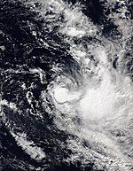
2021–22 South Pacific cyclone season
This article has multiple issues. Please help improve it or discuss these issues on the talk page. (Learn how and when to remove these messages)
|
| 2021–22 South Pacific cyclone season | |
|---|---|
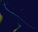
 Season summary map | |
| Seasonal boundaries | |
| First system formed | December 13, 2021 |
| Last system dissipated | May 21, 2022 |
| Strongest storm | |
| Name | Dovi |
| • Maximum winds | 175 km/h (110 mph) (10-minute sustained) |
| • Lowest pressure | 940 hPa (mbar) |
| Seasonal statistics | |
| Total disturbances | 11 official, 1 unofficial |
| Total depressions | 7 official, 1 unofficial |
| Tropical cyclones | 6 official, 1 unofficial |
| Severe tropical cyclones | 2 |
| Total fatalities | 2 total |
| Total damage | $96.9 million (2021 USD) |
| Related articles | |
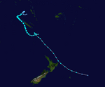
The 2021–22 South Pacific cyclone season was a near average tropical cyclone season within the South Pacific Ocean to the east of 160°E. The season officially started from November 1, 2021, and officially ended on April 30, 2022, however a tropical cyclone could form at any time between July 1, 2021, and June 30, 2022, and would count towards the season total. During the season, tropical cyclones will be officially monitored by the Fiji Meteorological Service, Australian Bureau of Meteorology and New Zealand's MetService. The United States Armed Forces through the Joint Typhoon Warning Center (JTWC) will also monitor the basin and issue unofficial warnings for American interests. The FMS attaches a number and an F suffix to tropical disturbances that form in or move into the basin while the JTWC designates significant tropical cyclones with a number and a P suffix. The BoM, FMS and MetService all use the Australian Tropical Cyclone Intensity Scale and estimate windspeeds over a period of ten minutes, while the JTWC estimated sustained winds over a 1-minute period, which are subsequently compared to the Saffir–Simpson hurricane wind scale (SSHWS).
Seasonal forecasts
[edit]| Source/Record | Region | Tropical Cyclones |
Severe Tropical Cyclones |
Refs | ||||||||||||||||||||||||||||||||||||||||
|---|---|---|---|---|---|---|---|---|---|---|---|---|---|---|---|---|---|---|---|---|---|---|---|---|---|---|---|---|---|---|---|---|---|---|---|---|---|---|---|---|---|---|---|---|
| Records | ||||||||||||||||||||||||||||||||||||||||||||
| Average (1969–70 – 2020–21): | 160°E – 120°W | 7 | 3 | [1] | ||||||||||||||||||||||||||||||||||||||||
| Record high: | 160°E – 120°W | 1997–98: 16 | 1982–83: 10 | [2] | ||||||||||||||||||||||||||||||||||||||||
| Record low: | 160°E – 120°W | 1990–91: 2 | 2008–09: 0 | [2] | ||||||||||||||||||||||||||||||||||||||||
| Predictions | ||||||||||||||||||||||||||||||||||||||||||||
| CWCL July | 135°E – 120°W | 7–11 | — | [3] | ||||||||||||||||||||||||||||||||||||||||
| CWCL August | 135°E – 120°W | 8–12 | — | [4] | ||||||||||||||||||||||||||||||||||||||||
| CWCL September | 135°E – 120°W | 9–11 | — | [5] | ||||||||||||||||||||||||||||||||||||||||
| CWCL October | 135°E – 120°W | 9–11 | — | [6] | ||||||||||||||||||||||||||||||||||||||||
| CWCL November | 135°E – 120°W | 9–12 | — | [7] | ||||||||||||||||||||||||||||||||||||||||
| CWCL December | 135°E – 120°W | 6–10 | — | [8] | ||||||||||||||||||||||||||||||||||||||||
| CWCL January | 135°E – 120°W | 3–7 | — | [9] | ||||||||||||||||||||||||||||||||||||||||
| NIWA October | 135°E – 120°W | 9–12 | 3–4 | [10] | ||||||||||||||||||||||||||||||||||||||||
| FMS Whole | 160°E – 120°W | 4–6 | 1–3 | [1] | ||||||||||||||||||||||||||||||||||||||||
Ahead of the cyclone season formally starting, the Fiji Meteorological Service (FMS), Australian Bureau of Meteorology (BoM), New Zealand's MetService and National Institute of Water and Atmospheric Research (NIWA) and various other Pacific Meteorological services, all contributed towards the Island Climate Update tropical cyclone outlook that was released during October 2021.[10] The outlook took into account the ENSO neutral conditions that had been observed across the Pacific and analogue seasons, that had ENSO neutral and La Nina conditions occurring during the season.[10] The outlook called for a near-average number of tropical cyclones for the 2021–22 season, with nine to twelve named tropical cyclones, predicted to occur between 135°E and 120°W, compared to an average of just over 10.[10] At least four of the tropical cyclones were expected to intensify further and become severe tropical cyclones, while it was noted that a Category 5 severe tropical cyclone could occur during the season.[10]
In addition to contributing towards the Island Climate Update outlook, the FMS and the BoM issued their own seasonal forecasts for the South Pacific region.[1][11] The BoM issued two seasonal forecasts for the Southern Pacific Ocean, for their self-defined eastern and western regions of the South Pacific Ocean.[11] They predicted that the Western region between 142.5°E and 165°E, had a 59% chance of seeing activity above its average of 4 tropical cyclones. The BoM also predicted that the Eastern Region between 165°E and 120°W, had a 46% chance of seeing activity above its average of 6 tropical cyclones.[11] Within their outlook the FMS predicted that between four and six tropical cyclones would occur within the basin compared to an average of around 7.[1] At least one of these tropical cyclones was expected to intensify further and become a Category 3 or higher severe tropical cyclone.[1]
Seasonal summary
[edit]
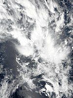
The season began on mid-December 2021 with the arrival of Tropical Cyclone Ruby from the Australian region as a Category 2 tropical cyclone, before making landfall in New Caledonia and dissipate. Tropical Disturbance 02F then developed late on the same month between Vanuatu and Fiji and moved westwards towards New Caledonia before dissipating. By January, Tropical Disturbance 03F formed, which would later become Severe Tropical Cyclone Cody. Cody then moved near Fiji before moving southwards again and weaken. Three more systems would later form during the month, with the first system, 04F, becoming a tropical depression as it moved west before weakening. The second system, 05F, developed between the southern Cook Islands and French Polynesia and remained a tropical disturbance. The third system, 06F, formed between Vanuatu and New Caledonia and also remained a tropical disturbance while moving southeast.
By February, Tropical Low 16U moved over the basin from the Australian region, and was redesignated as Tropical Disturbance 07F. It remained as a disturbance while moving southeast. Tropical Low 18U would also move over the basin, and be redesignated as 08F. 08F would later develop into Severe Tropical Cyclone Dovi, the strongest cyclone of the season. Dovi would later affect New Zealand as an extratropical cyclone. Late on the same month, Tropical Disturbance 09F would form near New Caledonia, and intensify into Tropical Cyclone Eva. Tropical Cyclone Fili would later form on the month of April, peaking as a Category 2 tropical cyclone before moving near New Caledonia and dissipating, and Tropical Cyclone Gina would form in the off-season, in the month of May, peaking as a Category 1 tropical cyclone before dissipating.[12]
Systems
[edit]Tropical Cyclone Ruby
[edit]| Category 2 tropical cyclone (Australian scale) | |
| Category 1 tropical cyclone (SSHWS) | |
| Duration | December 13 (Entered basin) – December 15 |
|---|---|
| Peak intensity | 110 km/h (70 mph) (10-min); 975 hPa (mbar) |
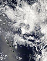
On December 13, Tropical Cyclone Ruby moved into the basin from the Australian region, as a Category 2 tropical cyclone on the Australian scale.[13][14] Late on the same day, it made landfall on New Caledonia, and weakened as it emerged from the country.[15] The FMS downgraded Ruby into a Category 1 tropical cyclone,[16] and the JTWC issued their final advisory shortly thereafter.[17] Ruby crossed into the MetService's area of responsibility, where it became an extratropical cyclone on December 15.[18]
Tropical Disturbance 02F
[edit]| Tropical disturbance (Australian scale) | |
| Duration | December 17 – December 20 |
|---|---|
| Peak intensity | 55 km/h (35 mph) (10-min); 1004 hPa (mbar) |
On December 17, the FMS reported that a tropical disturbance had developed in an area of low vertical wind shear, about 625 km (390 mi) to the northeast of Port Vila in Vanuatu. The FMS designated the tropical disturbance as 02F. Deep convection associated with the system persisted on a convergence line, away from the system's low-level circulation center.[19] By December 20 the FMS issuing their final warning.[20]
Severe Tropical Cyclone Cody
[edit]| Category 3 severe tropical cyclone (Australian scale) | |
| Tropical storm (SSHWS) | |
| Duration | January 5 – January 13 |
|---|---|
| Peak intensity | 130 km/h (80 mph) (10-min); 971 hPa (mbar) |
On 5 January, the FMS began monitoring a tropical disturbance near Fiji, designating the system as 03F.[21] Later that day, the Joint Typhoon Warning Center (JTWC) began monitoring 03F, though its development was inhibited due to wind shear.[22] The system's chances of developing increased,[23] and on 8 January, the JTWC issued a Tropical Cyclone Formation Alert for 03F.[24] On the same day at 21:00 UTC, the JTWC upgraded 03F to a tropical depression, assigning it the designation 05P.[25] 03F briefly weakened on the next day; however, it reorganized, with a satellite scatterometer pass showing winds of 35 knots (65 km/h; 40 mph) prompting the JTWC to upgrade it to a tropical storm.[26] On 10 January, the FMS upgraded 03F to a Category 1 cyclone on the Australian scale and assigned it the name Cody. The FMS estimated peak 10-minute sustained winds of 130 km/h (80 mph),[citation needed] with the JTWC estimating peak 1-minute sustained winds of 95 km/h (60 mph). The JTWC assessed that Cody transitioned into a subtropical cyclone on 11 January,[27] with the FMS issuing its last advisory for Cody late on 12 January.[28]
Cody caused heavy rain in Fiji as a tropical depression, leading to flooding and infrastructure damage. 4,000 people had to be evacuated from their homes.[29] On January 10, a man drowned in Fiji while attempting to cross a flooding river.[30]
Tropical Depression 04F
[edit]| Tropical depression (Australian scale) | |
| Duration | January 15 – January 18 |
|---|---|
| Peak intensity | 55 km/h (35 mph) (10-min); 999 hPa (mbar) |
Tropical Disturbance 04F formed on January 15, and its position was last noted on January 18 as a Tropical Depression.[citation needed]
Tropical Disturbance 05F
[edit]| Tropical disturbance (Australian scale) | |
| Duration | January 19 – January 22 |
|---|---|
| Peak intensity | 55 km/h (35 mph) (10-min); 999 hPa (mbar) |
Tropical Disturbance 05F formed on January 19 and dissipated on January 22. The JTWC reclassified it as a subtropical cyclone.[citation needed]
Tropical Disturbance 06F
[edit]| Tropical disturbance (Australian scale) | |
| Duration | January 28 – January 30 |
|---|---|
| Peak intensity | 55 km/h (35 mph) (10-min); 1001 hPa (mbar) |
During January 28, the FMS started to monitor a tropical disturbance, which had developed about 185 km (115 mi) to the west of Port Villa in Vanuatu. It was designated as 06F. 06F was last noted on January 30.[citation needed]
Tropical Disturbance 07F
[edit]| Tropical disturbance (Australian scale) | |
| Duration | February 3 (Entered basin) – February 7 |
|---|---|
| Peak intensity | 55 km/h (35 mph) (10-min); 998 hPa (mbar) |
On February 3, Tropical Low 16U entered the basin and was reclassified as Tropical Disturbance 07F by the FMS. 07F was last noted on February 7, near New Caledonia.[citation needed]
Severe Tropical Cyclone Dovi
[edit]| Category 4 severe tropical cyclone (Australian scale) | |
| Category 2 tropical cyclone (SSHWS) | |
| Duration | February 6 – February 12 |
|---|---|
| Peak intensity | 175 km/h (110 mph) (10-min); 940 hPa (mbar) |
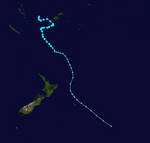
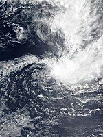
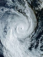
On February 4, the United States Joint Typhoon Warning Center reported that a tropical disturbance had developed within the Australian region about 1,285 km (800 mi) to the west of New Caledonia.[31] The disturbance was starting to develop a low-level circulation, which was accompanied by fragmented atmospheric convection, along a frontal boundary that extended across the Cape York Peninsula and the Coral Sea.[31] Over the next couple of days, the Australian Bureau of Meteorology (BoM) and the Fiji Meteorological Service (FMS) started to monitor the poorly organized system as Tropical Low 18U and Tropical Disturbance 08F, as it moved eastwards within the frontal boundary towards Vanuatu and the South Pacific basin.[32][33][34] During February 7, the system started to slowly consolidate, as it passed to the north of New Caledonia, before the FMS classified the system as a tropical depression.[35][36] At this stage, the depression was moving eastwards and was predicted to continue to move eastwards towards Fiji, however, the depression slowed down as it approached the islands of southern Vanuatu during February 8.
Government buildings were closed around lunchtime on 9 February, as residents packed grocery stores for supplies. As Cyclone Dovi moved through Vanuatu, heavy rainfall was observed which resulted in major flash flooding.[37] Over 400 people nationwide had to flee to shelters due to the cyclone.[38] Schools across northern and southern New Caledonia, and the Loyalty Islands all businesses, public buildings, and schools were closed. Multiple evacuation centres were opened across the Loyalty Islands.[39] The MetService of New Zealand declared the extratropical remnants of Dovi a "significant weather event". The NZ Transport Agency warned of the closure of the Auckland Harbour Bridge, which was closed on the morning of 13 February. More than 100 Air New Zealand flights were cancelled due to the storm.[40]
Tropical Cyclone Eva
[edit]| Category 1 tropical cyclone (Australian scale) | |
| Tropical storm (SSHWS) | |
| Duration | February 26 – March 5 |
|---|---|
| Peak intensity | 65 km/h (40 mph) (10-min); 995 hPa (mbar) |
On February 26, a tropical disturbance formed and was designated as 09F by the FMS; it intensified to a tropical depression on the next day. On March 3, The JTWC upgraded the system into a tropical cyclone and identified it as 18P. The tropical depression intensified into a Category 1 tropical cyclone and was named Eva. The peak was short-lived, as Eva moved to the southeast and the JTWC reclassified Eva as a subtropical cyclone. Eva dissipated on March 5. The remnants of Eva intensified the rainfall during the 2022 eastern Australia floods in late February and early March.[citation needed]
Tropical Cyclone Fili
[edit]| Category 2 tropical cyclone (Australian scale) | |
| Tropical storm (SSHWS) | |
| Duration | April 3 – April 9 |
|---|---|
| Peak intensity | 110 km/h (70 mph) (10-min); 977 hPa (mbar) |
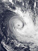
During April 3, the FMS and the BoM started to monitor Tropical Disturbance 10F/31U, which had developed about 410 km (255 mi) to the northwest of Port Vila in Vanuatu.[41][42] The next day, in an unofficial bulletin, the JTWC classified the system as a "tropical cyclone", when it reached 35 knots on the Saffir-Simpson scale.[43] The FMS did the same and was named Fili. The eye formed at its center, and the FMS upgraded the system to Category 2 cyclone with 10-min winds at 70 mph and a pressure of 977 mbar. Fili started to weaken as it moved to an area of subtropical confection and the JTWC reclassified Fili as a subtropical storm. Fili dissipated on April 9.[citation needed]
MetService issued red heavy rain warnings in Gisborne and Wairoa as the cyclone approached the country.[44] Fili brought heavy rain and wind to areas around East Cape on April 12 and 13, leading to flooding, downed trees, power outages, and closed roads.[45]
Tropical Cyclone Gina
[edit]| Category 1 tropical cyclone (Australian scale) | |
| Tropical storm (SSHWS) | |
| Duration | May 16 – May 21 |
|---|---|
| Peak intensity | 75 km/h (45 mph) (10-min); 998 hPa (mbar) |
During May 16, the FMS reported that Tropical Disturbance 11F had developed, about 600 km (375 mi) to the northeast of Port Vila, Vanuatu. At this time, the system had a broad low-level circulation centre, which had light winds of 5–10 mph (10–20 km/h) associated with it. Over the next day, atmospheric convection consolidated over the low level circulation center, within a favourable environment for further development with robust outflow, low-moderate vertical windshear and warm sea-surface temperatures of around 29–30 °C (84–86 °F). As a result, the JTWC issued a tropical cyclone formation alert (TCFA) on the disturbance and warned that there was a high potential for the disturbance to develop into a tropical cyclone, as it moved south-westwards towards Vanuatu. The FMS subsequently reported that the disturbance had developed into a tropical depression, while it was located about 435 km (270 mi) to the northeast of Port Vila. The JTWC subsequently cancelled the TCFA during May 18, after the depression had veered westwards from its south-westwards track, into an area of high vertical wind shear, while its low level circulation became fully exposed and decoupled from its central deep overcast.
Later that day, the JTWC initiated advisories on the depression and designated it as Tropical Cyclone 26P, after a fresh area of atmospheric convection had started to grow and expand over the low-level circulation. The FMS subsequently reported that the depression had developed into a category 1 tropical cyclone and named it Gina, after winds of 45 mph (75 km/h) had been observed near the systems centre. The newly named system subsequently struggled to overcome the effects of the vertical windshear and maintain deep persistent atmospheric convection, as it moved south-westwards along the subtropical ridge of high pressure. Gina dissipated on May 21.
Heavy rain associated with Gina caused flooding to be reported in various parts of Vanuatu, including at Port Vila's Bauerfield Airport which caused both domestic and international flights to be cancelled.
Other system
[edit]
On January 13, 2022, the Weather Prediction Center (WPC) noted a subtropical storm approximately 440 nmi (810 km; 510 mi) to the west-southwest of the Juan Fernández Islands.[46] The small storm dissipated the next day.[47] Similar to previous storms that formed in this region, it was unofficially named Humberto by researchers, in honor of Humberto Fuenzalida.[48]
Storm names
[edit]Within the Southern Pacific, a tropical depression is judged to have reached tropical cyclone intensity should it reach winds of 65 km/h (40 mph) and it is evident that gales are occurring at least halfway around the center. With tropical depressions intensifying into a tropical cyclone between the Equator and 25°S and between 160°E – 120°W named by the FMS. However should a tropical depression intensify to the south of 25°S between 160°E and 120°W it will be named in conjunction with the FMS by MetService. Should a tropical cyclone move out of the basin and into the Australian region it will retain its original name. The names Cody, and Eva, were used for the first time this season (and only in case of Cody), which replaced Cilla and Eseta in the 2002–03 season. The names that were used for 2021–22 season are listed below:[49]
|
|
|
If a tropical cyclone enters the South Pacific basin from the Australian region basin (west of 160°E), it will retain the name assigned to it by the BoM. The following storms were named in this manner:
Retirement
[edit]After the season, the name Cody was retired due to the damages it caused, and was replaced with Carol.[49]
Season effects
[edit]This table lists all the storms that developed in the South Pacific to the east of longitude 160°E during the 2021–22 season. It includes their intensity on the Australian tropical cyclone intensity scale, duration, name, landfalls, deaths, and damages. All data is taken from RSMC Nadi and/or TCWC Wellington, and all of the damage figures are in 2021 or 2022 USD.
| Name | Dates active | Peak intensity | Areas affected | Damage (US$) |
Deaths | Refs | ||
|---|---|---|---|---|---|---|---|---|
| Category | Wind speed | Pressure | ||||||
| Ruby | December 13 – 15 | Category 2 tropical cyclone | 110 km/h (70 mph) | 975 hPa (28.79 inHg) | New Caledonia | Minimal | None | |
| 02F | December 17 – 20 | Tropical disturbance | 55 km/h (35 mph) | 1004 hPa (29.65 inHg) | None | None | None | |
| Cody | January 5 – 13 | Category 3 severe tropical cyclone | 130 km/h (80 mph) | 971 hPa (28.67 inHg) | Fiji | $12.9 million | 1 | [50] |
| 04F | January 15 – 18 | Tropical depression | 55 km/h (35 mph) | 999 hPa (29.50 inHg) | Cook Islands, Niue | None | None | |
| 05F | January 19 – 22 | Tropical disturbance | 55 km/h (35 mph) | 999 hPa (29.50 inHg) | None | None | None | |
| 06F | January 28 – 30 | Tropical disturbance | 55 km/h (35 mph) | 1001 hPa (29.56 inHg) | New Caledonia | None | None | |
| 07F | February 3 – 7 | Tropical disturbance | 55 km/h (35 mph) | 998 hPa (29.47 inHg) | New Caledonia | None | None | |
| Dovi | February 6 – 12 | Category 4 severe tropical cyclone | 175 km/h (110 mph) | 940 hPa (27.76 inHg) | Vanuatu, New Caledonia Norfolk Island, New Zealand |
$84 million | 1 | [51] |
| Eva | February 26 – March 5 | Category 1 tropical cyclone | 65 km/h (40 mph) | 995 hPa (29.38 inHg) | Vanuatu, New Caledonia | Unknown | None | |
| Fili | April 3 – 9 | Category 2 tropical cyclone | 110 km/h (70 mph) | 977 hPa (28.85 inHg) | New Caledonia | Unknown | None | |
| Gina | May 16 – 21 | Category 1 tropical cyclone | 75 km/h (45 mph) | 998 hPa (29.47 inHg) | Vanuatu, New Caledonia | Unknown | None | |
| Season aggregates | ||||||||
| 11 systems | December 13, 2021 – May 21, 2022 | 175 km/h (110 mph) | 940 hPa (27.76 inHg) | $96.9 million | 2 | |||
See also
[edit]- Weather of 2021 and 2022
- List of Southern Hemisphere cyclone seasons
- Tropical cyclones in 2021 and 2022
- Atlantic hurricane seasons: 2021, 2022
- Pacific hurricane seasons: 2021, 2022
- Pacific typhoon seasons: 2021, 2022
- North Indian Ocean cyclone seasons: 2021, 2022
- 2021–22 South-West Indian Ocean cyclone season
- 2021–22 Australian region cyclone season
- Unusual areas of tropical cyclone formation
- Subtropical Cyclone Katie
- Subtropical Cyclone Lexi
References
[edit]- ^ a b c d e "2021/22 Regional Specialized Meteorological Centre Nadi: Tropical Cyclone Seasonal Outlook" (PDF). Fiji Meteorological Service. October 13, 2021. Archived (PDF) from the original on October 13, 2021. Retrieved October 14, 2021.
- ^ a b Climate Services Division (October 26, 2010). Tropical Cyclone Guidance for Season 2010/11 for the Fiji and the Southwest Pacific (PDF) (Report). Fiji Meteorological Service. Archived (PDF) from the original on May 19, 2024. Retrieved May 19, 2024.
- ^ Magee, Andrew (July 23, 2021). "July 2021 Long-Range Outlook for the 2021/22 Southwest Pacific Tropical Cyclone Season" (PDF). Australian Centre for Water, Climate and Land. Archived (PDF) from the original on October 25, 2023. Retrieved October 25, 2023.
- ^ Magee, Andrew (August 18, 2021). "August 2021 Long-Range Outlook for the 2021/22 Southwest Pacific Tropical Cyclone Season" (PDF). Australian Centre for Water, Climate and Land. Retrieved November 19, 2022.
- ^ Magee, Andrew (September 22, 2021). "September 2021 Long-Range Outlook for the 2021/22 Southwest Pacific Tropical Cyclone Season" (PDF). Australian Centre for Water, Climate and Land. Retrieved October 20, 2023.
- ^ Magee, Andrew (October 12, 2021). "October 2021 Long-Range Outlook for the 2021/22 Southwest Pacific Tropical Cyclone Season" (PDF). Australian Centre for Water, Climate and Land. Retrieved October 20, 2023.
- ^ Magee, Andrew (November 17, 2021). "November 2021 Long-Range Outlook for the 2021/22 Southwest Pacific Tropical Cyclone Season" (PDF). Australian Centre for Water, Climate and Land. Retrieved October 20, 2023.
- ^ Magee, Andrew (December 17, 2021). "December 2021 Long-Range Outlook for the 2021/22 Southwest Pacific Tropical Cyclone Season" (PDF). Australian Centre for Water, Climate and Land. Retrieved October 20, 2023.
- ^ Magee, Andrew (January 21, 2022). "January 2022 Long-Range Outlook for the 2021/22 Southwest Pacific Tropical Cyclone Season" (PDF). Australian Centre for Water, Climate and Land. Retrieved October 20, 2023.
- ^ a b c d e Southwest Pacific Tropical Cyclone Outlook - October 2021 (Report). National Institute of Water and Atmospheric Research. October 12, 2021. Archived from the original on October 12, 2021. Retrieved May 22, 2022.
- ^ a b c "South Pacific Tropical Cyclone Outlook for 2021 to 2022". Australian Bureau of Meteorology. October 12, 2021. Archived from the original on October 23, 2021. Retrieved December 14, 2021.
- ^ Fiji Meteorological Service (August 20, 2022). RSMC Nadi Review of the Cyclone Seasons 2021/2022 (Report). World Meteorological Organization. Retrieved January 13, 2023.
- ^ "Tropical Cyclone Forecast Map Number 1 for Tropical Cyclone Ruby". met.gov.fj. Fiji Meteorological Service. December 13, 2021. Archived from the original on December 13, 2021. Retrieved December 13, 2021.
- ^ "Hurricane Warning 009 for Tropical Cyclone Ruby". met.gov.fj. Fiji Meteorological Service. December 12, 2021. Archived from the original on December 13, 2021. Retrieved December 13, 2021.
- ^ Bilan Métorologique du Passage de la Dépression Tropicale Forte Ruby du 13 au 14 Décembre 2021 [Meteorological assessment of the passage of the Strong Tropical Depression Ruby from 13 to 14 December 2021] (Report) (in French). Météo-France Nouvelle-Calédonie. December 17, 2021. Retrieved January 16, 2023.
- ^ "Tropical Disturbance Advisory Number A6 for Tropical Cyclone Ruby". Fiji Meteorological Service. December 14, 2021. Archived from the original on December 13, 2021. Retrieved January 16, 2023 – via MT Archive.
- ^ Tropical Cyclone 03P (Ruby) Warning No. 13 (Report). United States Joint Typhoon Warning Center. December 14, 2021. Archived from the original on December 12, 2021. Retrieved December 14, 2021. Alt URL
- ^ "Gale Warning 100 for Low former Cyclone Ruby". New Zealand Meteorological Service. December 15, 2021. Archived from the original on December 13, 2022. Retrieved January 17, 2023 – via MT Archive.
- ^ "Tropical Disturbance Summary For area Equator to 25S, 160E to 120W ISSUED FROM RSMC NADI Dec 170155 UTC". met.gov.fj. Fiji Meteorological Service. December 17, 2021. Archived from the original on December 17, 2021. Retrieved December 20, 2021.
- ^ "Tropical Disturbance Summary For area Equator to 25S, 160E to 120W ISSUED FROM RSMC NADI Dec 202316 UTC". met.gov.fj. Fiji Meteorological Service. December 20, 2021. Archived from the original on January 5, 2022. Retrieved December 20, 2021.
- ^ "Tropical Disturbance Summary For area Equator to 25S, 160E to 120W Issued from RSMC Nadi Jan 050954 UTC". Fiji Meteorological Service. January 5, 2022. Archived from the original on January 4, 2022. Retrieved January 5, 2022.
- ^ "Significant Tropical Weather Advisory for the Western and South Pacific Ocean Reissued 052030Z–060600Z January 2022". Joint Typhoon Warning Center. January 5, 2022. Archived from the original on December 21, 2021. Retrieved January 16, 2022.
- ^ "Significant Tropical Weather Advisory for the Western and South Pacific Ocean Reissued 080100Z–080600Z January 2022". Joint Typhoon Warning Center. January 8, 2022. Archived from the original on December 21, 2021. Retrieved January 16, 2022.
- ^ Tropical Cyclone Formation Alert (Invest 99P) (Report). United States Joint Typhoon Warning Center. January 8, 2022. Archived from the original on January 8, 2022. Retrieved January 16, 2022. Alt URL
- ^ Tropical Depression 05P (03F) Warning No. 1 (Report). United States Joint Typhoon Warning Center. January 8, 2022. Archived from the original on January 8, 2022. Retrieved January 16, 2022. Alt URL
- ^ Tropical Storm 05P (03F) Warning No. 4 (Report). United States Joint Typhoon Warning Center. January 9, 2022. Archived from the original on January 9, 2022. Retrieved January 16, 2022. Alt URL
- ^ "05P Best Track". United States Naval Research Laboratory. Archived from the original on January 9, 2022. Retrieved January 16, 2022.
- ^ "Tropical Disturbance Advisory Number A19 Issued from RSMC Nadi Jan 121915 UTC". Fiji Meteorological Service. January 12, 2022. Archived from the original on January 16, 2022. Retrieved January 16, 2022.
- ^ "Fiji begins massive clean up after Cyclone Cody". Stuff. January 14, 2022. Retrieved January 15, 2022.
- ^ Lice Monovo (January 9, 2022). "Fiji cyclone: Man drowns attempting to cross flooded river". Newshub. Fiji: RNZ Pacific. Archived from the original on January 11, 2022. Retrieved January 9, 2022.
- ^ a b Significant Tropical Weather Advisory for the Western and South Pacific Oceans February 4, 2022 18:30z (Report). United States Joint Typhoon Warning Center. February 4, 2022. Archived from the original on April 5, 2022. Retrieved April 6, 2022.
- ^ Tropical Cyclone Dovi (Report). Australian Bureau of Meteorology. Archived from the original on April 4, 2022. Retrieved April 4, 2022.
- ^ Significant Tropical Weather Advisory for the Western and South Pacific Oceans February 6, 2022 06:00z (Report). United States Joint Typhoon Warning Center. February 5, 2022.
- ^ Tropical Disturbance Summary February 6, 2022 21z (Report). Fiji Meteorological Service. February 6, 2022. Archived from the original on February 8, 2022. Retrieved February 6, 2022.
- ^ Significant Tropical Weather Advisory for the Western and South Pacific Oceans February 7, 2022 06:00z (Report). United States Joint Typhoon Warning Center. February 7, 2022. Archived from the original on March 30, 2022. Retrieved April 7, 2022.
- ^ Tropical Disturbance Summary February 7, 2022 21z (Report). Fiji Meteorological Service. February 7, 2022. Archived from the original on March 15, 2022. Retrieved February 7, 2022.
- ^ "Tropical Cyclone Dovi causes major flooding in Vanuatu", Radio New Zealand, February 10, 2022, retrieved June 21, 2022
- ^ Willie, Glenda (February 17, 2022), "Families urged to relocate to safe locations", Vanuatu Daily Post, retrieved June 21, 2022
- ^ "Vanuatu, New Caledonia – Tropical Storm DOVI (GDACS, JTWC, VMGD, Meteo New Caledonia, Government New Caledonia, Civil Protection New Caledonia, media) (ECHO Daily Flash of 10 February 2022)", ReliefWeb, ECHO, February 10, 2022, retrieved June 21, 2022
- ^ Howie, Cherie (February 12, 2022), "Weather: Cyclone Dovi strikes New Zealand – heavy wind, rain in Wellington, Auckland and across North Island, top of South Island", New Zealand Herald, retrieved June 21, 2022
- ^ Tropical Disturbance Summary for April 3, 2022 06z (Report). Fiji Meteorological Service. April 3, 2022.
- ^ Tropical Cyclone Outlook for The Coral Sea April 3, 2022 (Report). Australian Bureau Of Meteorology. April 3, 2022. Archived from the original on February 8, 2022. Retrieved April 3, 2022.
{{cite report}}: CS1 maint: bot: original URL status unknown (link) - ^ "Technical bulletin of the TC 23P". JTWC. April 4, 2022. Archived from the original on April 6, 2022. Retrieved April 4, 2022.
{{cite web}}: CS1 maint: bot: original URL status unknown (link) - ^ Green, Kate (April 12, 2022). "Gisborne and Hawke's Bay prepare for heavy rain as Cyclone Fili nears". Stuff. Retrieved February 14, 2023.
- ^ Sharpe, Gianina Schwanecke and Marty (April 13, 2022). "Cyclone Fili: Power outages, roads cut off north of Gisborne as storm worsens". Stuff. Retrieved February 14, 2023.
- ^ "South American Forecast Discussion". Weather Prediction Center. January 13, 2022. Archived from the original on January 15, 2022. Retrieved January 15, 2022.
- ^ "South American Forecast Discussion". Weather Prediction Center. January 14, 2022. Archived from the original on January 15, 2022. Retrieved January 15, 2022.
- ^ Steve Young (2022). "Monthly Global Tropical Cyclone Tracks, January 2022". Retrieved February 26, 2023.
- ^ a b RA V Tropical Cyclone Committee (2024). Tropical Cyclone Operational Plan for the South-East Indian Ocean and the Southern Pacific Ocean 2024 (PDF) (Report). World Meteorological Organization. Retrieved October 14, 2024.
- ^ Kotobalavu, Josefa (January 20, 2022). "Combined damage to infrastructure exceeds $27m with FRA hard hit". Mai TV. Archived from the original on January 21, 2022. Retrieved January 21, 2022.
- ^ 2023 Weather, Climate and Catastrophe Insight (pdf). AON (Report). January 25, 2023. Retrieved January 31, 2024.


