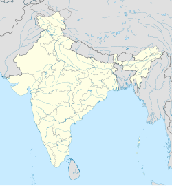
Bhatgaon, Lucknow
Bhatgaon
Bhatgāon | |
|---|---|
Village | |
| Coordinates: 26°42′19″N 80°46′49″E / 26.705365°N 80.780385°E[1] | |
| Country | |
| State | Uttar Pradesh |
| District | Lucknow |
| Area | |
• Total | 9.813 km2 (3.789 sq mi) |
| Population (2011)[2] | |
• Total | 7,131 |
| • Density | 730/km2 (1,900/sq mi) |
| Languages | |
| • Official | Hindi |
| Time zone | UTC+5:30 (IST) |
Bhatgaon is a village in Sarojaninagar block of Lucknow district, Uttar Pradesh, India.[2] As of 2011, its population was 7,131, in 1,353 households.[2] A regular market is held here.[2] The village lands cover an area of 981.3 hectares, of which 681.9 (69.4%) were farmland in 2011.[2] Areas under non-agricultural use covered 67.5 hectares, or 6.9% of the total village area.[2]
History
[edit]Around the turn of the 20th century, Bhatgaon was described as a "very large village in the south-west of the pargana" of Bijnaur, held by a Sheikh family in pattidari tenure.[3] It was surrounded by tanks, which formed the main source of irrigation.[3] The soil was described as "a light loam with a tendency to sand", and the main crops grown here were bajra, barley, and rice.[3] The 1901 census recorded a population of 2,105 people, of whom 294 were Muslim; the main Hindu group was the Kachhis.[3] There was a small school, which had been established in 1864.[3]
References
[edit]- ^ "Geographic Names Search WebApp". Search for "Bhatgaon" here.
- ^ a b c d e f g "Census of India 2011: Uttar Pradesh District Census Handbook - Lucknow, Part A (Village and Town Directory)". Census 2011 India. pp. 166–183. Retrieved 19 April 2021.
- ^ a b c d e Nevill, H.R. (1904). Lucknow - A Gazetteer. Allahabad: Government Press. pp. 174–5. Retrieved 19 April 2021.


