Bacabal
Appearance
(Redirected from Bacabal, Maranhão)
Bacabal | |
|---|---|
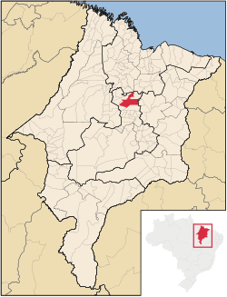
 Location in Maranhão state | |
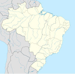
| Coordinates: 4°13′30″S 44°46′48″W / 4.22500°S 44.78000°W | |
| Country | Brazil |
| Region | Northeast |
| State | Maranhão |
| Population (2018)[1] | |
• Total | 104,633 |
| Time zone | UTC−3 (BRT) |
Bacabal is a city in Maranhão, Brazil. It is located approximately 250 km south of the state capital São Luís. The city proper has a population of 104,633 (IBGE 2018 estimate).[1] It is the seat of the Roman Catholic Diocese of Bacabal.[2]
The municipality contains a small part of the Baixada Maranhense Environmental Protection Area, a 1,775,035.6 hectares (4,386,208 acres) sustainable use conservation unit created in 1991 that has been a Ramsar Site since 2000.[3]
Climate
[edit]| Climate data for Bacabal (1981–2010) | |||||||||||||
|---|---|---|---|---|---|---|---|---|---|---|---|---|---|
| Month | Jan | Feb | Mar | Apr | May | Jun | Jul | Aug | Sep | Oct | Nov | Dec | Year |
| Mean daily maximum °C (°F) | 32.7 (90.9) |
32.4 (90.3) |
32.3 (90.1) |
32.3 (90.1) |
32.7 (90.9) |
32.7 (90.9) |
33.1 (91.6) |
34.7 (94.5) |
36.1 (97.0) |
36.2 (97.2) |
35.6 (96.1) |
34.4 (93.9) |
33.8 (92.8) |
| Daily mean °C (°F) | 27.2 (81.0) |
26.9 (80.4) |
26.8 (80.2) |
27.3 (81.1) |
27.2 (81.0) |
27.1 (80.8) |
27.3 (81.1) |
28.0 (82.4) |
28.9 (84.0) |
29.1 (84.4) |
28.9 (84.0) |
28.3 (82.9) |
27.8 (82.0) |
| Mean daily minimum °C (°F) | 22.8 (73.0) |
23.2 (73.8) |
23.4 (74.1) |
23.6 (74.5) |
23.8 (74.8) |
22.9 (73.2) |
22.3 (72.1) |
22.6 (72.7) |
23.1 (73.6) |
23.5 (74.3) |
23.8 (74.8) |
23.5 (74.3) |
23.2 (73.8) |
| Average precipitation mm (inches) | 263.8 (10.39) |
263.8 (10.39) |
390.4 (15.37) |
358.4 (14.11) |
195.0 (7.68) |
54.6 (2.15) |
17.9 (0.70) |
14.6 (0.57) |
10.6 (0.42) |
35.4 (1.39) |
67.8 (2.67) |
135.3 (5.33) |
1,807.6 (71.17) |
| Average precipitation days (≥ 1.0 mm) | 16 | 16 | 21 | 20 | 13 | 6 | 2 | 1 | 2 | 4 | 5 | 9 | 115 |
| Average relative humidity (%) | 82.0 | 83.7 | 84.8 | 85.1 | 80.8 | 76.9 | 73.4 | 68.3 | 65.5 | 66.4 | 68.5 | 74.8 | 75.9 |
| Mean monthly sunshine hours | 155.4 | 138.4 | 140.6 | 148.6 | 199.1 | 241.3 | 262.1 | 272.3 | 241.2 | 214.5 | 186.4 | 176.9 | 2,376.8 |
| Source: Instituto Nacional de Meteorologia[4] | |||||||||||||
References
[edit]- ^ a b "Brazilian Institute of Geography and Statistics" (PDF). 2018. Retrieved 6 March 2019.
2018 Estimates of Population
- ^ "IBGE | Cidades | Maranhão | Bacabal". cidades.ibge.gov.br. Retrieved 2016-05-19.
- ^ APA Baixada Maranhense (in Portuguese), ISA: Instituto Socioambiental, retrieved 2016-06-13
- ^ "Normais Climatológicas Do Brasil 1981–2010" (in Portuguese). Instituto Nacional de Meteorologia. Retrieved 21 May 2024.


