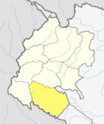
Gauriganga
Appearance
Gauriganga Municipality
गौरीगंगाा नगरपालिका | |
|---|---|
| Lua error in Module:Location_map at line 526: Unable to find the specified location map definition: "Module:Location map/data/Nepal Sudurpashchim Pradesh" does not exist. | |
| Coordinates: 28°46′N 80°46′E / 28.77°N 80.76°E | |
| Country | |
| Province | Sudurpashchim Pradesh |
| District | Kailali District |
| Municipality | Gauriganga Municipality |
| Ward | 11 |
| Government | |
| • Mayor | Bhim Bahadur Deuba (NCP) |
| • Deputy Mayor | Anchala Chaudhary (NCP) |
| Area | |
| • Total | 244.44 km2 (94.38 sq mi) |
| Population (2011) | |
| • Total | 55,314 |
| • Density | 230/km2 (590/sq mi) |
| Languages | |
| • Official language | Nepali |
| • Local language | Tharu, Nepali, etc |
| Time zone | UTC+5:45 (NST) |
| Post code | 10900 |
| Area code | 091 |
| Website | www |
Gauriganga Municipality is a municipality in Kailali District in the Sudurpashchim Pradesh. At the time of the 2011 Nepal census it had a population of 55,314 living in 5,293 individual households. It is Surrounded by Ghodaghodi Municipality in the west, Godawari Municipality in the east, Mohanyal and Chure Rural Municipality in the north and Dhangadhi Sub Metropolitan City and Kailari Rural Municipality in the south.
Census
Total population of Gauriganga Municipality is 55,314,. Chhetree is the dominant caste followed by Tharu Ethnic group. Brahmin Ranked third with. The male to female sex-ratio is 96.47. Total 5,293 household. [1]
References
- ^ Nepal census 2011

