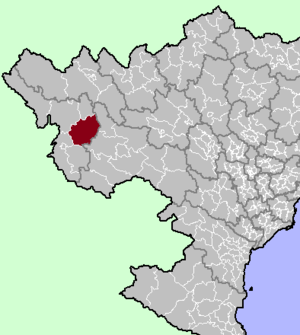
Tuần Giáo district
Appearance
You can help expand this article with text translated from the corresponding article in Vietnamese. (March 2009) Click [show] for important translation instructions.
|
Tuan Giao District
Huyện Tuần Giáo | |
|---|---|
Rural district | |
 District location in northern Vietnam | |
| Country | |
| Region | Northwest |
| Province | Dien Bien |
| Capital | Tuan Giao |
| Area | |
| • Total | 611 sq mi (1,583 km2) |
| Population (2003) | |
| • Total | 104,185 |
| Time zone | UTC+7 (UTC + 7) |
Tuần Giáo is a rural district of Dien Bien province in the Northwest region of Vietnam. As of 2003, the district had a population of 104,185.[1] The district covers an area of 1,583 km². The district capital lies at Tuan Giao.[1]
Administrative divisions
Tuan Giao has 14 administrative units, including 1 town and 13 communes:
References
- ^ a b "Districts of Vietnam". Statoids. Retrieved March 13, 2009.

