Rupse Falls
Appearance
| Rupse Falls | |
|---|---|
 A view of Rupse Falls. | |
 | |
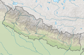
| Location | Dana VDC of Myagdi District, Nepal |
| Coordinates | 28°33′20″N 83°38′10″E / 28.5555°N 83.6361°E |
| Total height | 300 metres (980 ft) |
| Watercourse | Kali Gandaki River |
Rupse Falls (Nepali: रूप्से झरना) is a waterfall in central Nepal. It is located in Dana VDC of Myagdi District in Dhawalagiri Zone of western Nepal.[1] It is 300 meters (984 feet) tall.[2] The Rupse falls is a popular tourist destination.
Geography
[edit]Rupse is located in Beni-Jomsom Highway route. It is approximately 110 km from Pokhara and approximately 40.8 km from Jomsom.[3] Kali Gandaki Gorge, the deepest gorge in the world, and the Kali Gandaki river are nearby.
Waterfalls
[edit]The height of Rupse Falls is more than 300 meters.
Tourism
[edit]Annually roughly 1,500,000 tourist visit this site.[4]
Gallery
[edit]-
Rupse Falls
-
Rupse Falls
-
Rupse Falls in 2024
See also
[edit]References
[edit]- ^ "Falls in Nepal". Wondermando. 18 July 2014.
- ^ "ICIMOD Digital Photo Contest - Water and Life | Pankaj Prasad Raturi". www.icimod.org. Archived from the original on 2016-03-03.
- ^ "Along the Kali Gandaki - Nepali Times".
- ^ "Tourist arrival up in Rupse water fall". Gorkhapatra. Archived from the original on 26 December 2013. Retrieved 19 December 2013.


