Almagro (Madrid)
Appearance
You can help expand this article with text translated from the corresponding article in Spanish. (March 2022) Click [show] for important translation instructions.
|
Almagro | |
|---|---|
 | |
 | |
| Coordinates: 40°25′54″N 3°41′39″W / 40.43167°N 3.69417°W | |
| Country | Spain |
| Region | Community of Madrid |
| Municipality | Madrid |
| District | Chamberí |
 | |
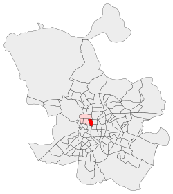
Almagro is an administrative neighborhood (barrio) of Madrid belonging to the district of Chamberí.
External links
[edit]![]() Media related to Almagro neighborhood, Madrid at Wikimedia Commons
Media related to Almagro neighborhood, Madrid at Wikimedia Commons
