
Fairwater, Wisconsin: Difference between revisions
GreenC bot (talk | contribs) Rescued 2 archive links; Move 2 urls. Wayback Medic 2.5 |
GreenC bot (talk | contribs) Move 6 urls. Wayback Medic 2.5 |
||
| Line 53: | Line 53: | ||
|population_est = 360 |
|population_est = 360 |
||
|pop_est_as_of = 2018 |
|pop_est_as_of = 2018 |
||
|population_footnotes = <ref name =" |
|population_footnotes = <ref name ="wwwcensusgov"/> |
||
|population_total = 371 |
|population_total = 371 |
||
|population_density_km2 = 189.14 |
|population_density_km2 = 189.14 |
||
| Line 71: | Line 71: | ||
|area_code = [[Area code 920|920]] |
|area_code = [[Area code 920|920]] |
||
|blank_name = [[Federal Information Processing Standard|FIPS code]] |
|blank_name = [[Federal Information Processing Standard|FIPS code]] |
||
|blank_info = 55-25075<ref name="GR2">{{cite web | |
|blank_info = 55-25075<ref name="GR2">{{cite web |url=https://www.census.gov |publisher=[[United States Census Bureau]] |access-date=2008-01-31 |title=U.S. Census website |df= }}</ref> |
||
|blank1_name = [[Geographic Names Information System|GNIS]] feature ID |
|blank1_name = [[Geographic Names Information System|GNIS]] feature ID |
||
|blank1_info = 1564827<ref name="GR3" /> |
|blank1_info = 1564827<ref name="GR3" /> |
||
| Line 85: | Line 85: | ||
==Geography== |
==Geography== |
||
Fairwater is located at {{coord|43|44|28|N|88|52|8|W|type:city}} (43.741047, -88.868887).<ref name="GR1">{{cite web|url=https://www.census.gov/ |
Fairwater is located at {{coord|43|44|28|N|88|52|8|W|type:city}} (43.741047, -88.868887).<ref name="GR1">{{cite web|url=https://www.census.gov/geographies/reference-files/time-series/geo/gazetteer-files.html|publisher=[[United States Census Bureau]]|accessdate=2011-04-23|date=2011-02-12|title=US Gazetteer files: 2010, 2000, and 1990}}</ref> |
||
According to the [[United States Census Bureau]], the village has a total area of {{convert|0.76|sqmi|sqkm|2}}, of which, {{convert|0.74|sqmi|sqkm|2}} of it is land and {{convert|0.02|sqmi|sqkm|2}} is water.<ref name="Gazetteer files">{{cite web|title=US Gazetteer files 2010 |url=https://www.census.gov/geo/www/gazetteer/files/Gaz_places_national.txt |publisher=[[United States Census Bureau]] |access-date=2012-11-18 |url-status=dead |archive-url=https://web.archive.org/web/20120125061959/http://www.census.gov/geo/www/gazetteer/files/Gaz_places_national.txt |archive-date=2012-01-25 |df= }}</ref> |
According to the [[United States Census Bureau]], the village has a total area of {{convert|0.76|sqmi|sqkm|2}}, of which, {{convert|0.74|sqmi|sqkm|2}} of it is land and {{convert|0.02|sqmi|sqkm|2}} is water.<ref name="Gazetteer files">{{cite web|title=US Gazetteer files 2010 |url=https://www.census.gov/geo/www/gazetteer/files/Gaz_places_national.txt |publisher=[[United States Census Bureau]] |access-date=2012-11-18 |url-status=dead |archive-url=https://web.archive.org/web/20120125061959/http://www.census.gov/geo/www/gazetteer/files/Gaz_places_national.txt |archive-date=2012-01-25 |df= }}</ref> |
||
| Line 103: | Line 103: | ||
|estimate=360 |
|estimate=360 |
||
|estref=<ref name="USCensusEst2018CenPopScriptOnlyDirtyFixDoNotUse">{{cite web|url=https://www.census.gov/programs-surveys/popest/data/tables.2018.html|title=Population and Housing Unit Estimates|accessdate=June 4, 2019}}</ref> |
|estref=<ref name="USCensusEst2018CenPopScriptOnlyDirtyFixDoNotUse">{{cite web|url=https://www.census.gov/programs-surveys/popest/data/tables.2018.html|title=Population and Housing Unit Estimates|accessdate=June 4, 2019}}</ref> |
||
|footnote=U.S. Decennial Census<ref name="DecennialCensus">{{cite web|url=https://www.census.gov/ |
|footnote=U.S. Decennial Census<ref name="DecennialCensus">{{cite web|url=https://www.census.gov/programs-surveys/decennial-census.html|title=Census of Population and Housing|publisher=Census.gov|access-date=June 4, 2015|df=}}</ref> |
||
}} |
}} |
||
===2010 census=== |
===2010 census=== |
||
As of the [[census]]<ref name =" |
As of the [[census]]<ref name ="wwwcensusgov">{{cite web|title=U.S. Census website|url=https://www.census.gov|publisher=[[United States Census Bureau]]|accessdate=2012-11-18}}</ref> of 2010, there were 371 people, 152 households, and 108 families living in the village. The [[population density]] was {{convert|501.4|PD/sqmi|PD/km2|1}}. There were 160 housing units at an average density of {{convert|216.2|/sqmi|/km2|1}}. The racial makeup of the village was 95.1% [[White (U.S. Census)|White]], 0.8% [[African American (U.S. Census)|African American]], 0.5% [[Native American (U.S. Census)|Native American]], 0.3% [[Asian (U.S. Census)|Asian]], and 3.2% from [[Race (U.S. Census)|other races]]. [[Hispanic (U.S. Census)|Hispanic]] or [[Latino (U.S. Census)|Latino]] of any race were 6.5% of the population. |
||
There were 152 households of which 30.3% had children under the age of 18 living with them, 61.8% were [[Marriage|married couples]] living together, 5.9% had a female householder with no husband present, 3.3% had a male householder with no wife present, and 28.9% were non-families. 25.0% of all households were made up of individuals and 9.9% had someone living alone who was 65 years of age or older. The average household size was 2.44 and the average family size was 2.90. |
There were 152 households of which 30.3% had children under the age of 18 living with them, 61.8% were [[Marriage|married couples]] living together, 5.9% had a female householder with no husband present, 3.3% had a male householder with no wife present, and 28.9% were non-families. 25.0% of all households were made up of individuals and 9.9% had someone living alone who was 65 years of age or older. The average household size was 2.44 and the average family size was 2.90. |
||
Revision as of 22:22, 9 April 2020
Fairwater, Wisconsin | |
|---|---|
 Panorama looking north on WIS 44 | |
 Location of Fairwater in Fond du Lac County, Wisconsin. | |
| Coordinates: 43°44′28″N 88°52′8″W / 43.74111°N 88.86889°W | |
| Country | |
| State | |
| County | Fond du Lac |
| Area | |
| • Total | 0.75 sq mi (1.95 km2) |
| • Land | 0.73 sq mi (1.90 km2) |
| • Water | 0.02 sq mi (0.05 km2) |
| Elevation | 948 ft (289 m) |
| Population | |
| • Total | 371 |
| • Estimate (2018)[4] | 360 |
| • Density | 489.80/sq mi (189.14/km2) |
| Time zone | UTC-6 (Central (CST)) |
| • Summer (DST) | UTC-5 (CDT) |
| Area code | 920 |
| FIPS code | 55-25075[5] |
| GNIS feature ID | 1564827[2] |
| Website | www |
Fairwater is a village in Fond du Lac County, Wisconsin, United States. The population was 371 at the 2010 census. The town of Metomen surrounds the village.
History
The community was founded around the water power of the Grand River in 1848 and was incorporated in 1921. The town prospered under a booming hemp economy spurred by the need for strong rope during World War I. Hemp brought direct income to Fairwater farmers, factory workers and the owners of the Fairwater Hemp Company.[6] An efficient, eco-friendly production process used unwanted parts of the hemp plant to fuel the factory's steam power system. The Fairwater Hemp Company closed in 1931.
Geography
Fairwater is located at 43°44′28″N 88°52′8″W / 43.74111°N 88.86889°W (43.741047, -88.868887).[7]
According to the United States Census Bureau, the village has a total area of 0.76 square miles (1.97 km2), of which, 0.74 square miles (1.92 km2) of it is land and 0.02 square miles (0.05 km2) is water.[8]
Demographics
| Census | Pop. | Note | %± |
|---|---|---|---|
| 1930 | 301 | — | |
| 1940 | 293 | −2.7% | |
| 1950 | 311 | 6.1% | |
| 1960 | 330 | 6.1% | |
| 1970 | 373 | 13.0% | |
| 1980 | 310 | −16.9% | |
| 1990 | 302 | −2.6% | |
| 2000 | 350 | 15.9% | |
| 2010 | 371 | 6.0% | |
| 2018 (est.) | 360 | [4] | −3.0% |
| U.S. Decennial Census[9] | |||
2010 census
As of the census[3] of 2010, there were 371 people, 152 households, and 108 families living in the village. The population density was 501.4 inhabitants per square mile (193.6/km2). There were 160 housing units at an average density of 216.2 per square mile (83.5/km2). The racial makeup of the village was 95.1% White, 0.8% African American, 0.5% Native American, 0.3% Asian, and 3.2% from other races. Hispanic or Latino of any race were 6.5% of the population.
There were 152 households of which 30.3% had children under the age of 18 living with them, 61.8% were married couples living together, 5.9% had a female householder with no husband present, 3.3% had a male householder with no wife present, and 28.9% were non-families. 25.0% of all households were made up of individuals and 9.9% had someone living alone who was 65 years of age or older. The average household size was 2.44 and the average family size was 2.90.
The median age in the village was 38.9 years. 23.5% of residents were under the age of 18; 6.9% were between the ages of 18 and 24; 28.3% were from 25 to 44; 26.9% were from 45 to 64; and 14.3% were 65 years of age or older. The gender makeup of the village was 50.7% male and 49.3% female.
2000 census
As of the census[5] of 2000, there were 350 people, 139 households, and 104 families living in the village. The population density was 470.8 people per square mile (182.6/km²). There were 142 housing units at an average density of 191.0 per square mile (74.1/km²). The racial makeup of the village was 99.43% White, and 0.57% from two or more races.
There were 139 households out of which 33.1% had children under the age of 18 living with them, 67.6% were married couples living together, 7.2% had a female householder with no husband present, and 24.5% were non-families. 21.6% of all households were made up of individuals and 10.1% had someone living alone who was 65 years of age or older. The average household size was 2.52 and the average family size was 2.94.
In the village, the population was spread out with 24.0% under the age of 18, 7.7% from 18 to 24, 31.4% from 25 to 44, 21.1% from 45 to 64, and 15.7% who were 65 years of age or older. The median age was 38 years. For every 100 females, there were 100.0 males. For every 100 females age 18 and over, there were 98.5 males.
The median income for a household in the village was $105,292, and the median income for a family was $51,250. Males had a median income of $36,875 versus $23,125 for females. The per capita income for the village was $19,281. About 3.7% of families and 3.6% of the population were below the poverty line, including 5.1% of those under age 18 and 5.8% of those age 65 or over.
Images
-
 Welcome sign
 -
 Sign
Sign -
 Civic center
 -
 Public school, now historical society
 -
 Looking west in Fairwater
 -
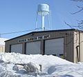 Fire station and water tower


References
- ^ "2018 U.S. Gazetteer Files". United States Census Bureau. Retrieved Feb 15, 2020.
- ^ a b "US Board on Geographic Names". United States Geological Survey. 2007-10-25. Retrieved 2008-01-31.
- ^ a b "U.S. Census website". United States Census Bureau. Retrieved 2012-11-18.
- ^ a b "Population and Housing Unit Estimates". Retrieved June 4, 2019.
- ^ a b "U.S. Census website". United States Census Bureau. Retrieved 2008-01-31.
- ^ Fairwater Hemp Company
- ^ "US Gazetteer files: 2010, 2000, and 1990". United States Census Bureau. 2011-02-12. Retrieved 2011-04-23.
- ^ "US Gazetteer files 2010". United States Census Bureau. Archived from the original on 2012-01-25. Retrieved 2012-11-18.
- ^ "Census of Population and Housing". Census.gov. Retrieved June 4, 2015.
External links
Municipalities and communities of Fond du Lac County, Wisconsin, United States | ||
|---|---|---|
| Cities |  | |
| Villages | ||
| Towns | ||
| CDPs | ||
| Other communities |
| |
| Former communities | ||
| Footnotes | ‡This populated place also has portions in an adjacent county or counties | |