Gauriganga: Difference between revisions
No edit summary |
m Disambiguating links to Lohar (link changed to Lohar (caste)) using DisamAssist. |
||
| (23 intermediate revisions by 13 users not shown) | |||
| Line 1: | Line 1: | ||
{{Infobox settlement |
{{Infobox settlement |
||
<!--See the table at Infobox settlement for all fields and descriptions of usage--> |
<!--See the table at Infobox settlement for all fields and descriptions of usage--> |
||
<!-- Basic info -->| name |
<!-- Basic info -->| name = Gauriganga Municipality |
||
| other_name |
| other_name = गौरीगंगाा नगरपालिका |
||
| native_name |
| native_name = गौरीगंगाा नगरपालिका |
||
| nickname |
| nickname = |
||
| settlement_type |
| settlement_type = [[Municipality]] |
||
| motto |
| motto = <!-- images and maps --> |
||
| image_skyline |
| image_skyline = |
||
| imagesize |
| imagesize = 250px |
||
| image_caption |
| image_caption = |
||
| image_flag |
| image_flag = |
||
| image_seal |
| image_seal = |
||
| image_map |
| image_map = |
||
| photo1a |
| photo1a = |
||
| mapsize |
| mapsize = |
||
| map_caption |
| map_caption = |
||
| pushpin_map |
| pushpin_map = Nepal Sudurpashchim Province#Nepal |
||
| pushpin_label_position |
| pushpin_label_position = bottom |
||
| pushpin_mapsize |
| pushpin_mapsize = 300 |
||
| pushpin_map_caption |
| pushpin_map_caption = Location in Nepal |
||
<!-- Location -->| subdivision_type |
<!-- Location -->| subdivision_type = Country |
||
| subdivision_name |
| subdivision_name = {{flag|Nepal}} |
||
| subdivision_type1 |
| subdivision_type1 = [[Provinces of Nepal|Province]] |
||
| subdivision_name1 |
| subdivision_name1 = [[Sudurpashchim Province|Sudurpashchim]] |
||
| subdivision_type2 |
| subdivision_type2 = [[Districts of Nepal|District]] |
||
| subdivision_name2 |
| subdivision_name2 = [[Kailali District|Kailali]] |
||
| subdivision_type3 |
| subdivision_type3 = [[Administrative divisions of Nepal#Cities and Municipality of Nepal|Municipality]] |
||
| subdivision_name3 |
| subdivision_name3 = [[Gauriganga Municipality]] |
||
| subdivision_type4 |
| subdivision_type4 = [[Ward (electoral subdivision)|Ward]] |
||
| subdivision_name4 |
| subdivision_name4 = 11 |
||
| ⚫ | |||
| local_languages = [[Tharu language|Tharu]] |
|||
| ⚫ | |||
| ⚫ | |||
| leader_name = Devi Dutta Kandel ([[Communist Party of Nepal (Maoist Centre)|Maoist Centre]]) |
|||
| ⚫ | |||
| ⚫ | |||
| ⚫ | |||
| ⚫ | |||
| ⚫ | |||
| ⚫ | |||
| ⚫ | |||
| ⚫ | |||
| ⚫ | |||
| ⚫ | |||
| ⚫ | |||
| ⚫ | |||
<!-- Demographics -->| demographics_type1 = Languages |
|||
| ⚫ | |||
| ⚫ | |||
| ⚫ | |||
| ⚫ | |||
| ⚫ | |||
<!--established, headquarters--> |
|||
| |
| utc_offset = +5:45 |
||
| ⚫ | |||
| incorporated_vdc = [[Gauriganga Municipality|Chaumala]], [[Masuriya]], and [[Udasipur]], |
|||
| |
| utc_offset_DST = |
||
| ⚫ | |||
| hq = Maghi Chauraha Chaumala New Market |
|||
| ⚫ | |||
| ⚫ | |||
| ⚫ | |||
| ⚫ | |||
| ⚫ | |||
| ⚫ | |||
| ⚫ | |||
| ⚫ | |||
| ⚫ | |||
| ⚫ | '''Gauriganga Municipality ''' is a municipality in [[Kailali District]] in the [[Sudurpashchim Province]]. At the time of the [[2011 Nepal census]] it had a population of 55,314 living in 5,293 individual households. It is Surrounded by [[Ghodaghodi Municipality]] in the west, [[Godawari, Sudurpashchim|Godawari Municipality]] in the east, [[Mohanyal]] and [[Chure Rural Municipality]] in the north and [[Dhangadhi|Dhangadhi Sub Metropolitan City]] and [[Kailari Rural Municipality]] in the south. |
||
==Demographics== |
|||
| ⚫ | |||
At the time of the [[2011 Nepal census]], Gauriganga Municipality had a population of 58,286. Of these, 32.8% spoke [[Doteli]], 30.0% [[Tharu languages|Tharu]], 20.2% [[Nepali language|Nepali]], 10.3% [[Nepali language#Dialects|Achhami]], 1.6% [[Nepali language#Dialects|Bajhangi]], 1.4% [[Magar language|Magar]], 1.2% [[Nepali language#Dialects|Bajureli]], 0.5% [[Magar Kham language|Kham]], 0.5% [[Raji language|Raji]], 0.3% [[Nepali language#Dialects|Baitadeli]], 0.3% [[Maithili language|Maithili]], 0.2% [[Nepali language#Dialects|Darchuleli]], 0.2% [[Hindi]], 0.2% [[Tamang language|Tamang]], 0.1% [[Gurung language|Gurung]] and 0.2% other languages as their first language.<ref>[https://nepalmap.org/data/table/?table=LANGUAGE&primary_geo_id=local-71005&geo_ids=local-71005,district-30,province-7,country-NP NepalMap Language]</ref> |
|||
| ⚫ | |||
| ⚫ | |||
| leader_name = Bhim Bahadur Deuba ([[Nepal Communist Party|NCP]]) |
|||
| ⚫ | |||
| ⚫ | |||
| ⚫ | |||
| ⚫ | |||
| ⚫ | |||
| ⚫ | |||
| ⚫ | |||
| ⚫ | |||
| ⚫ | |||
| ⚫ | |||
| ⚫ | |||
| ⚫ | |||
<!--established, headquarters-->| established = <!-- Demographics --> |
|||
| demographics_type1 = Languages |
|||
| ⚫ | |||
| demographics1_info1 = [[Acchami dialect of Nepali and Standard Nepali|Nepali]] |
|||
| ⚫ | |||
| ⚫ | |||
In terms of ethnicity/caste, 30.3% were [[Tharu people|Tharu]], 27.2% [[Chhetri]], 12.7% [[Kami (caste)|Kami]], 11.8% [[Bahun|Hill Brahmin]], 4.5% [[Magar people|Magar]], 4.3% [[Thakuri]], 3.4% [[Damai]]/Dholi, 1.4% [[Sarki (ethnic group)|Sarki]], 0.9% [[Lohar (caste)|Lohar]], 0.7% Sanyasi/Dasnami, 0.6% [[Badi people|Badi]], 0.6% [[Raji people|Raji]], 0.3% [[Newar people|Newar]], 0.2% [[Gurung people|Gurung]], 0.2% [[Hajjam]]/Thakur, 0.2% [[Tamang people|Tamang]], 0.1% [[Bengalis|Bengali]], 0.1% other [[Dalit]], 0.1% [[Halwai]], 0.1% [[Kumal people|Kumal]], 0.1% [[Nepalese Muslims|Musalman]], 0.1% other Terai and 0.1% others.<ref>[https://nepalmap.org/data/table/?table=CASTE&primary_geo_id=local-71005&geo_ids=local-71005,district-30,province-7,country-NP NepalMap Caste]</ref> |
|||
| ⚫ | |||
| utc_offset = +5:45 |
|||
| ⚫ | |||
| utc_offset_DST = |
|||
| ⚫ | |||
| ⚫ | |||
| ⚫ | |||
| ⚫ | |||
| ⚫ | |||
| ⚫ | |||
| ⚫ | |||
| ⚫ | |||
| ⚫ | |||
| ⚫ | |||
| ⚫ | |||
| ⚫ | '''Gauriganga Municipality ''' is a municipality in [[Kailali District]] in the [[Sudurpashchim |
||
In terms of religion, 94.2% were [[Hinduism in Nepal|Hindu]], 1.5% [[Buddhism in Nepal|Buddhist]], 1.0% [[Christianity in Nepal|Christian]], 0.1% [[Islam in Nepal|Muslim]] and 3.1% others.<ref>[https://nepalmap.org/data/table/?table=RELIGION&primary_geo_id=local-71005&geo_ids=local-71005,district-30,province-7,country-NP NepalMap Religion]</ref> |
|||
==Census== |
|||
Total population of Gauriganga Municipality is 55,314,. Chhetree is the dominant caste followed by Tharu Ethnic group. [[Brahmin]] Ranked third with. The male to female sex-ratio is 96.47. Total 5,293 household. <ref>Nepal census 2011</ref> |
|||
In terms of literacy, 62.6% could read and write, 3.6% could only read and 33.8% could neither read nor write.<ref>[https://nepalmap.org/data/table/?table=LITERACY_SEX&primary_geo_id=local-71005&geo_ids=local-71005,district-30,province-7,country-NP NepalMap Literacy]</ref> |
|||
==References== |
==References== |
||
| Line 91: | Line 87: | ||
[[Category:Populated places in Kailali District]] |
[[Category:Populated places in Kailali District]] |
||
[[Category:Municipalities in |
[[Category:Municipalities in Kailali District]] |
||
[[Category:Nepal municipalities established in 2017]] |
|||
{{ |
{{Kailali-geo-stub}} |
||
Latest revision as of 22:56, 22 October 2024
Gauriganga Municipality
गौरीगंगाा नगरपालिका गौरीगंगाा नगरपालिका | |
|---|---|
| Coordinates: 28°46′N 80°46′E / 28.77°N 80.76°E | |
| Country | |
| Province | Sudurpashchim |
| District | Kailali |
| Municipality | Gauriganga Municipality |
| Ward | 11 |
| Government | |
| • Mayor | Devi Dutta Kandel (Maoist Centre) |
| • Deputy Mayor | Bhoj Bahadur Bam(Nepali Congress) |
| Area | |
| • Total | 244.44 km2 (94.38 sq mi) |
| Population (2021) | |
| • Total | 64,327 |
| • Density | 260/km2 (680/sq mi) |
| Languages | |
| • Official language | Nepali |
| • Local language | Khas (Bajhangi, Achhami, Doteli, Bajureli), Tharu, Khas Nepali, etc |
| Time zone | UTC+5:45 (NST) |
| Post code | 10900 |
| Area code | 091 |
| Website | www |
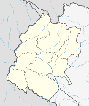
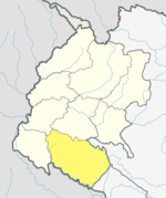
Gauriganga Municipality is a municipality in Kailali District in the Sudurpashchim Province. At the time of the 2011 Nepal census it had a population of 55,314 living in 5,293 individual households. It is Surrounded by Ghodaghodi Municipality in the west, Godawari Municipality in the east, Mohanyal and Chure Rural Municipality in the north and Dhangadhi Sub Metropolitan City and Kailari Rural Municipality in the south.
Demographics
[edit]At the time of the 2011 Nepal census, Gauriganga Municipality had a population of 58,286. Of these, 32.8% spoke Doteli, 30.0% Tharu, 20.2% Nepali, 10.3% Achhami, 1.6% Bajhangi, 1.4% Magar, 1.2% Bajureli, 0.5% Kham, 0.5% Raji, 0.3% Baitadeli, 0.3% Maithili, 0.2% Darchuleli, 0.2% Hindi, 0.2% Tamang, 0.1% Gurung and 0.2% other languages as their first language.[1]
In terms of ethnicity/caste, 30.3% were Tharu, 27.2% Chhetri, 12.7% Kami, 11.8% Hill Brahmin, 4.5% Magar, 4.3% Thakuri, 3.4% Damai/Dholi, 1.4% Sarki, 0.9% Lohar, 0.7% Sanyasi/Dasnami, 0.6% Badi, 0.6% Raji, 0.3% Newar, 0.2% Gurung, 0.2% Hajjam/Thakur, 0.2% Tamang, 0.1% Bengali, 0.1% other Dalit, 0.1% Halwai, 0.1% Kumal, 0.1% Musalman, 0.1% other Terai and 0.1% others.[2]
In terms of religion, 94.2% were Hindu, 1.5% Buddhist, 1.0% Christian, 0.1% Muslim and 3.1% others.[3]
In terms of literacy, 62.6% could read and write, 3.6% could only read and 33.8% could neither read nor write.[4]
References
[edit]External links
[edit]- UN map of the municipalities of Kailali District
- Official website of ddc Kaialali
- City Population - Gauriganga Municipality in Nepal


