Eagle Peak (New Mexico): Difference between revisions
Appearance
Content deleted Content added
No edit summary |
Entranced98 (talk | contribs) Adding local short description: "Mountain in New Mexico, United States", overriding Wikidata description "mountain in New Mexico, United States of America" |
||
| (22 intermediate revisions by 17 users not shown) | |||
| Line 1: | Line 1: | ||
{{Short description|Mountain in New Mexico, United States}} |
|||
{{Orphan|date=February 2009}} |
|||
{{Infobox |
{{Infobox mountain |
||
| |
| name = Eagle Peak |
||
| |
| photo = |
||
| |
| photo_caption = |
||
| elevation_ft = 9801 |
|||
| Elevation ={{convert|9786|ft|m|0|abbr=on}}<ref name="Summit">[http://www.summitpost.org/area/range/356250/tularosa-mountains.html "Tularosa Mountains" Summit Post]</ref> |
|||
| elevation_ref = {{navd88}}<ref name="ngs">{{cite ngs |id=DT0708 |name=Eagle Peak ET |accessdate=2011-05-14}}</ref> |
|||
| Location = [[New Mexico]] |
|||
| prominence_ft = 2266 |
|||
| ⚫ | |||
| prominence_ref = <ref name="pb">{{cite peakbagger |id=17281 |name=Eagle Peak, New Mexico |access-date=2011-05-14}}</ref> |
|||
| Prominence = {{convert|2286|ft|m|0|abbr=on}}<ref name="Summit"/> |
|||
| listing = |
|||
| Coordinates = {{coord|33|40|36|N|108|34|27|W|type:mountain_region:US}} |
|||
| location = [[Catron County, New Mexico|Catron County]], [[New Mexico]], [[United States|U.S.]] |
|||
| Topographic map = |
|||
| ⚫ | |||
| ⚫ | |||
| |
| map = New Mexico |
||
| |
| map_caption = |
||
| map_size = 200 |
|||
| First ascent = |
|||
| |
| label = |
||
| |
| label_position = |
||
| coordinates = {{coord|33.676918003|N|108.576982264|W|type:mountain_region:US-NM_scale:100000_source:NGS|format=dms|display=inline,title}} |
|||
| Translation = |
|||
| |
| range_coordinates = |
||
| coordinates_ref = <ref name="ngs"/> |
|||
| Pronunciation = |
|||
| topo = [[United States Geological Survey|USGS]] Eagle Peak |
|||
| ⚫ | |||
| age = |
|||
| last_eruption = |
|||
| first_ascent = |
|||
| easiest_route = |
|||
}} |
}} |
||
'''Eagle Peak''' is a mountain in western [[New Mexico]], the highest point in the [[Tularosa Mountains]]. |
|||
'''Eagle Peak''' is a mountain in [[Catron County, New Mexico]], near the town of [[Reserve, New Mexico|Reserve]].<ref>{{Cite book |last1=Survey |first1=United States Coast and Geodetic Survey |url=https://books.google.com/books?id=hGb_5iE1DwEC&dq=Eagle+Peak+Reserve,+New+Mexico&pg=PA198 |title=Triangulation in New Mexico: 1927 Datum |last2=Culley |first2=Frank Lambuth |date=1940 |publisher=U.S. Government Printing Office |language=en}}</ref> The summit is the highest point in the Tularosa Mountains.<ref>{{Cite book |last=Office |first=United States Bureau of Land Management New Mexico State |url=https://books.google.com/books?id=OfVfK06y16sC&dq=Eagle+Peak+New+Mexico&pg=SA19-PA1 |title=New Mexico Statewide Wilderness Study: Appendices, wilderness analysis reports (Las Cruces District) |date=1986 |publisher=U.S. Department of the Interior, Bureau of Land Management, New Mexico State Office |language=en}}</ref> |
|||
==Notes== |
|||
<references /> |
|||
{{-}} |
|||
==References== |
|||
{{reflist}} |
|||
==External links== |
|||
* {{cite summitpost |id=356250 |name=Tularosa Mountains |accessdate=2011-05-14}} |
|||
{{Mountains of New Mexico}} |
|||
[[Category:Landforms of Catron County, New Mexico]] |
|||
[[Category:Mountains of New Mexico]] |
[[Category:Mountains of New Mexico]] |
||
[[Category:Mountains of Catron County, New Mexico]] |
|||
{{NewMexico-geo-stub}} |
{{NewMexico-geo-stub}} |
||
Latest revision as of 11:41, 27 July 2024
| Eagle Peak | |
|---|---|
| Highest point | |
| Elevation | 9,801 ft (2,987 m) NAVD 88[1] |
| Prominence | 2,266 ft (691 m)[2] |
| Coordinates | 33°40′37″N 108°34′37″W / 33.676918003°N 108.576982264°W[1] |
| Geography | |
| Location | Catron County, New Mexico, U.S. |
| Parent range | Tularosa Mountains |
| Topo map | USGS Eagle Peak |
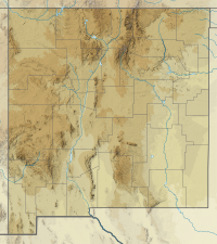
Eagle Peak is a mountain in Catron County, New Mexico, near the town of Reserve.[3] The summit is the highest point in the Tularosa Mountains.[4]
References
[edit]- ^ a b "Eagle Peak ET". NGS Data Sheet. National Geodetic Survey, National Oceanic and Atmospheric Administration, United States Department of Commerce. Retrieved 2011-05-14.
- ^ "Eagle Peak, New Mexico". Peakbagger.com. Retrieved 2011-05-14.
- ^ Survey, United States Coast and Geodetic Survey; Culley, Frank Lambuth (1940). Triangulation in New Mexico: 1927 Datum. U.S. Government Printing Office.
- ^ Office, United States Bureau of Land Management New Mexico State (1986). New Mexico Statewide Wilderness Study: Appendices, wilderness analysis reports (Las Cruces District). U.S. Department of the Interior, Bureau of Land Management, New Mexico State Office.
External links
[edit]- "Tularosa Mountains". SummitPost.org. Retrieved 2011-05-14.

