
Porvenir, Chile: Difference between revisions
m Fixing broken anchor: 2023-06-24 #Subpolar variety (Cfc)→Oceanic climate#Subpolar variety (Cfc, Cwc) |
|||
| (8 intermediate revisions by 2 users not shown) | |||
| Line 64: | Line 64: | ||
| utc_offset_DST = |
| utc_offset_DST = |
||
| blank_name_sec1 = [[Köppen climate classification|Climate]] |
| blank_name_sec1 = [[Köppen climate classification|Climate]] |
||
| blank_info_sec1 = [[Oceanic climate#Subpolar variety (Cfc)|Cfc]] |
| blank_info_sec1 = [[Oceanic climate#Subpolar variety (Cfc, Cwc)|Cfc]] |
||
| postal_code_type = |
| postal_code_type = |
||
| postal_code = |
| postal_code = |
||
| Line 99: | Line 99: | ||
== Climate == |
== Climate == |
||
The climate in Porvenir is a [[Oceanic climate#Subpolar variety (Cfc)|subpolar variety]] ([[Köppen climate classification|Köppen]]: ''Cfc'') of the [[oceanic climate]]. Temperatures in the warmest months, January and February average 10 |
The climate in Porvenir is a [[Oceanic climate#Subpolar variety (Cfc, Cwc)|subpolar variety]] ([[Köppen climate classification|Köppen]]: ''Cfc'') of the [[oceanic climate]]. Temperatures in the warmest months, January and February average {{convert|10.7|C|1}} while temperatures in the coolest month average {{convert|1.7|C|1}}. Precipitation is at around {{convert|749|mm|1}}. Also, due to its latitude, the length of the day varies tremendously across the year. Winter days can have as few as seven hours of sunlight, while summer days stretch to twenty hours. Frost occurs throughout the year, and winter temperatures can remain below freezing for relatively long periods of time. Freak snowfalls can occur even in midsummer. The highest temperature was {{convert|32.2|C|1}} in February 2019.<ref>{{cite web |url=http://blog.meteochile.gob.cl/2019/02/08/un-activo-verano-en-el-cono-sur/ |title=Un activo verano en el Cono Sur |last=Campos |first=Diego |date=February 8, 2019 |website=Meteochile Blog |publisher=Dirección Meteorológica de Chile |access-date=February 20, 2019 |quote=}}</ref><ref name=extremes/> |
||
{{Weather box |
{{Weather box |
||
|location = Porvenir |
|location = Porvenir (1991–2020, extremes 1986–present{{efn|Please enter the value "530005" in the parameter "Estación"}}) |
||
|metric first = yes |
|metric first = yes |
||
|single line = yes |
|single line = yes |
||
| Line 118: | Line 118: | ||
|Dec record high C = 27.4 |
|Dec record high C = 27.4 |
||
|year record high C = |
|year record high C = |
||
|Jan |
|Jan high C = 16.5 |
||
|Feb |
|Feb high C = 15.8 |
||
|Mar |
|Mar high C = 15.4 |
||
|Apr |
|Apr high C = 12.4 |
||
|May |
|May high C = 8.9 |
||
|Jun |
|Jun high C = 6.3 |
||
|Jul |
|Jul high C = 5.7 |
||
|Aug |
|Aug high C = 7.1 |
||
|Sep |
|Sep high C = 10.4 |
||
|Oct high C = 12.9 |
|||
|Nov high C = 14.1 |
|||
|Dec high C = 16.0 |
|||
|year high C = |
|||
|Jan mean C = 10.8 |
|||
|Feb mean C = 10.6 |
|||
|Mar mean C = 9.1 |
|||
|Apr mean C = 6.8 |
|||
|May mean C = 4.2 |
|||
|Jun mean C = 2.1 |
|||
|Jul mean C = 1.7 |
|||
|Aug mean C = 2.9 |
|||
|Sep mean C = 4.7 |
|||
|Oct mean C = 6.7 |
|Oct mean C = 6.7 |
||
|Nov mean C = |
|Nov mean C = 8.6 |
||
|Dec mean C = |
|Dec mean C = 10.1 |
||
|year mean C = |
|year mean C = |
||
|Jan low C = 4.8 |
|||
|Feb low C = 5.3 |
|||
|Mar low C = 4.0 |
|||
|Apr low C = 2.1 |
|||
|May low C = 0.1 |
|||
|Jun low C = -1.3 |
|||
|Jul low C = -1.9 |
|||
|Aug low C = -1.0 |
|||
|Sep low C = -0.5 |
|||
|Oct low C = 0.9 |
|||
|Nov low C = 3.3 |
|||
|Dec low C = 4.5 |
|||
|year low C = |
|||
|Jan record low C = -2.0 |
|Jan record low C = -2.0 |
||
|Feb record low C = -2.2 |
|Feb record low C = -2.2 |
||
| Line 144: | Line 170: | ||
|Dec record low C = -3.0 |
|Dec record low C = -3.0 |
||
|year record low C = |
|year record low C = |
||
| |
|precipitation colour = green |
||
| |
|Jan precipitation mm = 86 |
||
| |
|Feb precipitation mm = 65 |
||
| |
|Mar precipitation mm = 74 |
||
| |
|Apr precipitation mm = 74 |
||
| |
|May precipitation mm = 54 |
||
| |
|Jun precipitation mm = 47 |
||
| |
|Jul precipitation mm = 46 |
||
| |
|Aug precipitation mm = 49 |
||
| |
|Sep precipitation mm = 48 |
||
| |
|Oct precipitation mm = 56 |
||
| |
|Nov precipitation mm = 69 |
||
| |
|Dec precipitation mm = 81 |
||
|year precipitation mm = |
|||
|Jan precipitation days = 15 |
|||
|Feb precipitation days = 12 |
|||
|Mar precipitation days = 12 |
|||
|Apr precipitation days = 11 |
|||
|May precipitation days = 9 |
|||
|Jun precipitation days = 8 |
|||
|Jul precipitation days = 9 |
|||
|Aug precipitation days = 9 |
|||
|Sep precipitation days = 10 |
|||
|Oct precipitation days = 11 |
|||
|Nov precipitation days = 13 |
|||
|Dec precipitation days = 15 |
|||
|year precipitation days = |
|||
|Jan humidity = 70 |
|||
|Feb humidity = 71 |
|||
|Mar humidity = 73 |
|||
|Apr humidity = 77 |
|||
|May humidity = 80 |
|||
|Jun humidity = 82 |
|||
|Jul humidity = 82 |
|||
|Aug humidity = 79 |
|||
|Sep humidity = 76 |
|||
|Oct humidity = 71 |
|||
|Nov humidity = 69 |
|||
|Dec humidity = 69 |
|||
|year humidity = |
|||
|Jand sun = 8.4 |
|||
|Febd sun = 7.8 |
|||
|Mard sun = 6.6 |
|||
|Aprd sun = 5.5 |
|||
|Mayd sun = 4.8 |
|||
|Jund sun = 4.4 |
|||
|Juld sun = 4.6 |
|||
|Augd sun = 5.6 |
|||
|Sepd sun = 6.3 |
|||
|Octd sun = 7.6 |
|||
|Novd sun = 8.4 |
|||
|Decd sun = 8.7 |
|||
|yeard sun = |
|||
|source 1 = Climate-Data.org<ref name = "Climate-Data.org">{{cite web|url=http://en.climate-data.org/location/21749/|title = Climate: Porvenir|accessdate = 12 April 2014 |
|source 1 = Climate-Data.org<ref name = "Climate-Data.org">{{cite web|url=http://en.climate-data.org/location/21749/|title = Climate: Porvenir|accessdate = 12 April 2014 |
||
|publisher = Climate-Data.org}}</ref> |
|publisher = Climate-Data.org}}</ref> |
||
|source 2 = Dirección Meteorológica de Chile (normal temperatures and extremes)<ref name=promediotemp> |
|||
{{cite web |
|||
| archive-url = https://web.archive.org/web/20230527035928/https://climatologia.meteochile.gob.cl/application/historico/promedioTemperatura30/530005/2020 |
|||
| archive-date = 27 May 2023 |
|||
| url = https://climatologia.meteochile.gob.cl/application/historico/promedioTemperatura30/530005/2020 |
|||
| title = Temperaturas Medias y Extremas en 30 Años-Entre los años: 1991 al 2020-Nombre estación: Chacalluta, Arica Ap. |
|||
| publisher = Dirección Meteorológica de Chile |
|||
| language = es |
|||
| access-date = 27 May 2023}}</ref><ref name=extremes>{{Cite web|url=https://climatologia.meteochile.gob.cl/application/requerimiento/producto/RE3002|title=Temperatura Histórica de la Estación|language=es|date=2023-05-26|publisher=Dirección Meteorológica de Chile}}</ref> |
|||
}} |
}} |
||
=== |
=== Note === |
||
{{ |
{{notelist}} |
||
==Gallery== |
==Gallery== |
||
Latest revision as of 15:17, 15 September 2023
Porvenir
Karukinka | |
|---|---|
 A view of Porvenir | |
|
 Coat of arms  Map of Porvenir commune in Magallanes and Antarctica Chilena Region  Porvenir Location in Chile | |
| Coordinates: 53°17′S 70°22′W / 53.283°S 70.367°W | |
| Country | |
| Region | |
| Province | Tierra del Fuego |
| Founded | 1899 |
| Government | |
| • Type | Municipality |
| • Alcalde | Marisol Andrade Cárdenas (Christian Democratic Party) |
| Area | |
| • Total | 6,982.6 km2 (2,696.0 sq mi) |
| Elevation | 17 m (56 ft) |
| Population (2012 Census)[2] | |
| • Total | 5,907 |
| • Density | 0.85/km2 (2.2/sq mi) |
| • Urban | 4,734 |
| • Rural | 731 |
| Demonym(s) | Porvenireño, -a |
| Sex | |
| • Men | 3,307 |
| • Women | 2,158 |
| Time zone | UTC−3 (CLST) |
| Area code | 61 |
| Climate | Cfc |
| Website | Official website (in Spanish) |
Porvenir is the capital of both the homonymous commune and the Chilean Province of Tierra del Fuego of the Magallanes y la Antártica Chilena Region. It is one of Chile's southernmost towns, and has 4,734 inhabitants, including several thousand soldiers. It is the largest settlement in the Chilean half of the island of Tierra del Fuego.
Porvenir (Spanish for "hereafter" – literally "yet to come") was founded in 1883 by immigrants from Croatia[citation needed] and Chiloé in connection to the gold mining that preceded the larger Tierra del Fuego gold rush that started in 1884.
The main sources of income are sheep farming and small-scale fishing (wrecks in Porvenir bay prevent larger vessels from mooring). In addition there is a regiment of the Chilean army and a high-security prison. An abattoir operates for only short periods of the year.
Some gold deposits remain and are commercially mined. Porvenir also gives access to Cerro Sombrero, an oil town, 125 km (78 mi) north-east of Porvenir.
Demographics
[edit]
According to the 2002 census of the National Statistics Institute, Porvenir spans an area of 6,982.6 km2 (2,696 sq mi) and has 5,465 inhabitants (3,307 men and 2,158 women). Of these, 4,734 (86.6%) lived in urban areas and 731 (13.4%) in rural areas. The population grew by 7.1% (361 persons) between the 1992 and 2002 censuses.[2]
Administration
[edit]As a commune, Porvenir is a third-level administrative division of Chile administered by a municipal council, headed by an alcalde who is directly elected every four years. The 2016-2020 alcaldesa is Marisol Andrade Cárdenas .[1]
Within the electoral divisions of Chile, Porvenir is represented in the Chamber of Deputies by Juan Morano (PDC) and Gabriel Boric (Ind.) as part of the 60th electoral district, which includes the entire Magallanes y la Antártica Chilena Region. The commune is represented in the Senate by Carlos Bianchi Chelech (Ind.) and Carolina Goic (PDC) as part of the 19th senatorial constituency (Magallanes y la Antártica Chilena Region).
Tourism
[edit]
Though tourism is expanding, most tourists pass Porvenir by, or use it simply as a stopover on their way farther south. There are several hotels, cyber-cafes, restaurants, and one gas station. A small grocery store is located near the Chilean army base on the upper level of the town, and there are several small stores and supermarkets elsewhere in town.
Access is by ferry or by air from Punta Arenas or by road from the Argentine side of the island. All ferries across the Straits of Magellan are run by Austral Broom, a Chilean company. One service runs once daily except Mondays from the port near Punta Arenas and reaches the ferry terminal about 3 km from the town of Porvenir. The other service is at the northern end of the island running from Punta Delgada to Bahia Azul.
It is possible to reach the south of Chilean Tierra del Fuego from Porvenir. The southern region has several lakes and rivers available for fishing.
Climate
[edit]The climate in Porvenir is a subpolar variety (Köppen: Cfc) of the oceanic climate. Temperatures in the warmest months, January and February average 10.7 °C (51.3 °F) while temperatures in the coolest month average 1.7 °C (35.1 °F). Precipitation is at around 749 millimetres (29.5 in). Also, due to its latitude, the length of the day varies tremendously across the year. Winter days can have as few as seven hours of sunlight, while summer days stretch to twenty hours. Frost occurs throughout the year, and winter temperatures can remain below freezing for relatively long periods of time. Freak snowfalls can occur even in midsummer. The highest temperature was 32.2 °C (90.0 °F) in February 2019.[3][4]
| Climate data for Porvenir (1991–2020, extremes 1986–present[a]) | |||||||||||||
|---|---|---|---|---|---|---|---|---|---|---|---|---|---|
| Month | Jan | Feb | Mar | Apr | May | Jun | Jul | Aug | Sep | Oct | Nov | Dec | Year |
| Record high °C (°F) | 26.7 (80.1) |
32.2 (90.0) |
26.0 (78.8) |
20.8 (69.4) |
14.2 (57.6) |
13.2 (55.8) |
14.9 (58.8) |
13.6 (56.5) |
18.2 (64.8) |
20.9 (69.6) |
25.2 (77.4) |
27.4 (81.3) |
32.2 (90.0) |
| Mean daily maximum °C (°F) | 16.5 (61.7) |
15.8 (60.4) |
15.4 (59.7) |
12.4 (54.3) |
8.9 (48.0) |
6.3 (43.3) |
5.7 (42.3) |
7.1 (44.8) |
10.4 (50.7) |
12.9 (55.2) |
14.1 (57.4) |
16.0 (60.8) |
11.8 (53.2) |
| Daily mean °C (°F) | 10.8 (51.4) |
10.6 (51.1) |
9.1 (48.4) |
6.8 (44.2) |
4.2 (39.6) |
2.1 (35.8) |
1.7 (35.1) |
2.9 (37.2) |
4.7 (40.5) |
6.7 (44.1) |
8.6 (47.5) |
10.1 (50.2) |
6.5 (43.8) |
| Mean daily minimum °C (°F) | 4.8 (40.6) |
5.3 (41.5) |
4.0 (39.2) |
2.1 (35.8) |
0.1 (32.2) |
−1.3 (29.7) |
−1.9 (28.6) |
−1.0 (30.2) |
−0.5 (31.1) |
0.9 (33.6) |
3.3 (37.9) |
4.5 (40.1) |
1.7 (35.0) |
| Record low °C (°F) | −2.0 (28.4) |
−2.2 (28.0) |
−4.4 (24.1) |
−5.8 (21.6) |
−10.0 (14.0) |
−10.2 (13.6) |
−15.7 (3.7) |
−10.8 (12.6) |
−7.0 (19.4) |
−4.8 (23.4) |
−2.9 (26.8) |
−3.0 (26.6) |
−15.7 (3.7) |
| Average precipitation mm (inches) | 86 (3.4) |
65 (2.6) |
74 (2.9) |
74 (2.9) |
54 (2.1) |
47 (1.9) |
46 (1.8) |
49 (1.9) |
48 (1.9) |
56 (2.2) |
69 (2.7) |
81 (3.2) |
749 (29.5) |
| Average precipitation days | 15 | 12 | 12 | 11 | 9 | 8 | 9 | 9 | 10 | 11 | 13 | 15 | 134 |
| Average relative humidity (%) | 70 | 71 | 73 | 77 | 80 | 82 | 82 | 79 | 76 | 71 | 69 | 69 | 75 |
| Mean daily sunshine hours | 8.4 | 7.8 | 6.6 | 5.5 | 4.8 | 4.4 | 4.6 | 5.6 | 6.3 | 7.6 | 8.4 | 8.7 | 6.6 |
| Source 1: Climate-Data.org[5] | |||||||||||||
| Source 2: Dirección Meteorológica de Chile (normal temperatures and extremes)[6][4] | |||||||||||||
Note
[edit]- ^ Please enter the value "530005" in the parameter "Estación"
Gallery
[edit]-
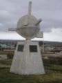 Monumento a los Inmigrantes.
 -
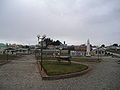
 Monumento en la Plaza de Armas.
 -
 Parque Croata.
 -
 San Francisco De Sales Church
 -
 Porvenir.


References
[edit]- ^ a b "Municipality of Porvenir" (in Spanish). Retrieved 3 December 2010.
- ^ a b c d "National Statistics Institute" (in Spanish). Retrieved 3 December 2010.
- ^ Campos, Diego (February 8, 2019). "Un activo verano en el Cono Sur". Meteochile Blog. Dirección Meteorológica de Chile. Retrieved February 20, 2019.
- ^ a b "Temperatura Histórica de la Estación" (in Spanish). Dirección Meteorológica de Chile. 2023-05-26.
- ^ "Climate: Porvenir". Climate-Data.org. Retrieved 12 April 2014.
- ^ "Temperaturas Medias y Extremas en 30 Años-Entre los años: 1991 al 2020-Nombre estación: Chacalluta, Arica Ap" (in Spanish). Dirección Meteorológica de Chile. Archived from the original on 27 May 2023. Retrieved 27 May 2023.
